Monte Zatta
| Monte Zatta | ||
|---|---|---|
| height | 1404 m slm | |
| location | Metropolitan City of Genoa and Province of La Spezia , Italy | |
| Mountains | Ligurian Apennines | |
| Coordinates | 44 ° 23 '31 " N , 9 ° 12' 45" E | |
|
|
||
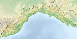
The Monte Zatta (in Ligurian: Sàtta ) is a mountain in the Ligurian Apennines which, at 1,404 meters high, forms a barrier between the Ligurian Sea and the Aveto Valley . The mountain itself does not have a single peak, but consists of a long ridge with a few distinctive high points, such as Monte Zatta di Ponente (1355 meters), Monte Zatta di Levante (1404 meters) and Monte Prato Pinello (1390 meters).
The mountain can be reached from the regional capital Genoa via the A12 motorway . After the Lavagna motorway exit , a road leads through Val Fontanabuona and Val Graveglia to Passo del Biscia (892 meters), from where the last section of the Cinque Terre high- altitude hiking trail (AV5T) leads to the summit. Further starting points for the ascent are at the Passo del Bocco (956 meters) in the metropolitan city of Genoa and at the Passo di Colla Craiola (905 meters) in the province of La Spezia .
The 35th section of the Ligurian High Trail , which connects Ventimiglia with Ceparana over a length of 440 kilometers , leads past Monte Zatta.
