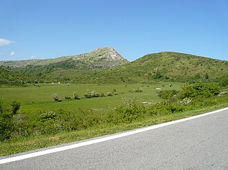
Passo del Biscia
| Passo del Biscia | |||
|---|---|---|---|
|
The Oneto level |
|||
| Compass direction | west | east | |
| Pass height | 892 m slm | ||
| province | Metropolitan city of Genoa , Italy | La Spezia Province , Italy | |
| Valley locations | No | Varese Ligure | |
| expansion | Pass road | ||
| Mountains | Ligurian Apennines | ||
| map | |||
|
|
|||
| Coordinates | 44 ° 21 '56 " N , 9 ° 29' 23" E | ||
The Passo del Biscia (in German: Nattern Pass ) is a pass in the Italian region of Liguria that connects the municipalities of Ne in the metropolitan city of Genoa and Varese Ligure in the province of La Spezia . The pass crossing is at a height of 892 meters above sea level.
The pass can be reached from Val Graveglia on the provincial road SP 26 and on the SP 57 from Varese Ligure. Two secondary roads connect to the Passo del Biscia, which lead in the direction of Statale near Ne and Valletti near Varese Ligure.
The pass is in the area of the Piani di Oneto , a smaller plateau between Monte Chiappozzo and Monte Porcile . The Cinque Terre high hiking trail also leads over the pass.

