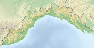
Monte Bue
| Monte Bue | ||
|---|---|---|
| height | 1777 m slm | |
| location | Metropolitan City of Genoa ( Liguria ) and Province of Parma ( Emilia-Romagna ), Italy | |
| Mountains | Ligurian Apennines | |
| Coordinates | 44 ° 33 '21 " N , 9 ° 29' 35" E | |
|
|
||
The Monte Bue is a 1777 m slm high summit in the area of the Monte Maggiorasca , the highest mountain in the Ligurian Apennines .
It lies between the Val d'Aveto and the Valle del Ceno. The provincial border between Liguria and Parma runs over its summit .
Monte Bue is a popular destination for hikers with Lago Nero , Monte Nero and Monte Maggiorasca in the vicinity. On its slopes there is a bivouac (Bivacco Sacchi), a mountain hut (Prato Cipolla) and the via ferrata “Ferrata Mazzocchi”. There is a restaurant and a weather station on the summit. Since 2010 there has been a chair lift to the summit of Monte Bue as part of a larger ski area.
Individual evidence
- ^ Monte Bue, Italy. Peakbagger.com, accessed August 22, 2018 .
- ^ Stazione Meteo Monte Bue. Associazione Ligure di Meteorologia, accessed August 22, 2018 (Italian).
- ↑ Santo Stefano d'Aveto ski area. SSD Sport Turismo e Servizi, accessed August 22, 2018 (Italian).
