
Lagoa Funda das Lajes
| Lagoa Funda | ||
|---|---|---|
.jpg)
|
||
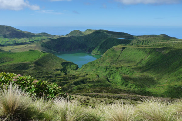
| Lagoa Funda (left) and Lagoa Rasa (right) | ||
| Geographical location | Lajes das Flores County , Flores , Azores , Portugal | |
| Data | ||
| Coordinates | 39 ° 24 ′ 21 ″ N , 31 ° 13 ′ 4 ″ W | |
|
||
| Altitude above sea level | approx. 400 m | |
| surface | 35 ha | |
| length | 900 m | |
| width | 600 m | |
| Maximum depth | 22 m | |

Lagoa Funda ( Portuguese for "deep lake", also Caldeira Funda ) is a crater lake in the central mountainous region in the southwest of the Portuguese Azores island of Flores , which belongs to the Lajes das Flores district.
The lake is located in the Reserva Natural das Caldeira Funda e Rasa nature reserve . It is part of the Sete Lagoas ("Seven Lakes"), all of which are located in the Flores highlands and formed in volcanic craters . Immediately adjacent to the northwest is the smaller, but 150 m higher lake, Lagoa Rasa , also in a Caldeira . The other five lakes of Sete Lagoas are called Lagoa Branca , Lagoa Comprida , Lagoa Funda (lake of the same name, also called Lagoa Negra), Lagoa da Lomba and Lagoa Seca .
The lake with its steep edges is 22 m deep and about 35 hectares in size. It lies at an altitude of about 400 m and is fed by the waterfall of the Ribeira Funda, along with other tributaries.
The area is characterized by lush vegetation with remains of the Laurisilva .
Web links
Individual evidence
- ↑ Secretaria Regional do Ambiente e do Mar: Plano de Ordenamento das Bacias Hidrográficas das Lagoas Branca, Negra, Funda, Comprida, Rasa, Lomba e Patas - Ilha das Flores. Relatório do Estudo Prévio de Ordenamento. 2011, p. 33
- ↑ The plateau. azoren-online.com, accessed March 7, 2012 .