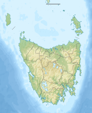
Lake King William
| Lake King William | ||
|---|---|---|
| Geographical location | Tasmania ( Australia ) | |
| Tributaries | Derwent River , Navarre River , Little Navarre River , Tarraleah Canal No. 2 | |
| Drain | Derwent River | |
| Places on the shore | Derwent Bridge | |
| Data | ||
| Coordinates | 42 ° 14 ′ S , 146 ° 14 ′ E | |
|
|
||
| Altitude above sea level | 715 m | |
| surface | 43 km² | |
| length | 12 km | |
| width | 8 kilometers | |
The Lake King William is a lake in the west of the Australian state of Tasmania .
It is located at the northeast end of the Franklin Gordon Wild Rivers National Park . The Derwent River flows through it and takes in the Navarre River and this the Little Navarre River . To the southwest of the lake is the Guelf Basin , a secondary lake that is connected to the main part of the lake by a narrow, short channel.
The lake and the King William Range to the west (with the mountains King William I , King William II and King William III - from north to south) were named after Dutch kings.
The water draining from the lake is routed through the Butlers Gorge Power Station to generate electricity.
Sources and web links
- Lake King William - TAS . ExplorOz.com
- Map of Lake King William, TAS . Bonzle.com
- Steve Parish: Australian Touring Atlas . Steve Parish Publishing, Archerfield QLD 2007. ISBN 978-1-74193-232-4 . P. 58
