Lake Margaret (Tasmania)
| Lake Margaret (Tasmania) | |||||||||||
|---|---|---|---|---|---|---|---|---|---|---|---|
|
|||||||||||
|
|
|||||||||||
| Coordinates | 42 ° 0 ′ 0 ″ S , 145 ° 32 ′ 0 ″ E | ||||||||||
| Data on the structure | |||||||||||
| Construction time: | until 1918 | ||||||||||
| Height of the structure crown: | 17 m | ||||||||||
| Building volume: | 6th 000 m³ | ||||||||||
| Crown length: | 243 m | ||||||||||
| Radius of curvature : | 0 m | ||||||||||
| Data on the reservoir | |||||||||||
| Altitude (at congestion destination ) | 662 m | ||||||||||
| Water surface | 1.7 km² | ||||||||||
| Reservoir length | 2.7 km | ||||||||||
| Reservoir width | 750 m | ||||||||||
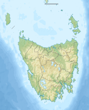
The Lake Margaret is a reservoir in the west of the Australian state of Tasmania . It is high up on the north slopes of Mount Sedgwick , a mountain in the West Coast Range . The Yolande River has its source in the lake.
dam
The dam was completed in 1918. It was the first gravity dam in Tasmania and was built of concrete with conglomerate "plums". The wall is 17 m high and has a crown length of 243 m. The volume of the dam is 6,000 m³. In 1974 it was reinforced by installing prestressed concrete anchors and grouting open joints.
power plant
At the same time as the dam, the Lake Margaret Power Station and a settlement that was also called Lake Margaret were built . The power station provided electricity for the nearby mines and settlements of the Mount Lyell Mining and Railway Company . The mining and railroad company was based in Queenstown . In the 1990s, Hydro Tasmania took over the power plant operation.
Catchment area
Several smaller lakes - some with their own names, others not - are located above the reservoir. Land exchange between the current operator of the power plant and the state government of Tasmania ensured that the catchment area of the reservoir now belongs to Hydro Tasmania, while the surrounding land belongs to either the Tyndall Regional Reserve or the Lake Beatrice Conservation Area - both state protected areas.
The two southern outflows arise on the slopes of Mount Sedgwick, the western of which flows through Lake Barnables (less than 1 km east of Lake Margaret) and Lake Phillip . The eastern outfall rises on a lake with no name and flows through the Lake Polycarp, the Lake Peter, the Lake Paul and Lake Apollo in Lake Phillip.
The northern outfall flows through the Lake Monica, the Lake Myra, the Lake Magdalene (782 m), the Lake Martha (757 m) and finally to Lake Mary (732 m) before the Margaret Lake ends.
The larger and slightly lower natural lake in this area is located southeast of Mount Sedgwick and is called Lake Beatrice .
Lake Margaret Tram
Until a road was built in 1964, Lake Margaret could only be reached with the Lake Margaret Tram .
Sources and web links
- Bruce Cole (Editor): Dam Technology in Australia 1850-1999 . Australian National Committee on Large Dams Inc.
- Geoffrey Blainey: The Peaks of Lyell , 6th Edition. Edition, St. David's Park Publishing, Hobart 2000, ISBN 0-7246-2265-9 .
- Charles Whitham: Western Tasmania - A Land of Riches and Beauty , Reprint 2003. Edition, Municipality of Queenstown, Queenstown 2003.
- Map of Lake Margaret, TAS . Bonzle.com
