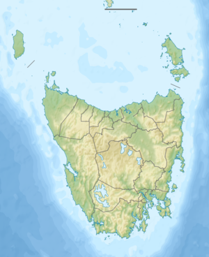
Lake Sorell
| Lake Sorell | ||
|---|---|---|
| Geographical location | Tasmania ( Australia ) | |
| Tributaries | Mountain Creek | |
| Drain | Clyde River | |
| Places on the shore | Interlaken | |
| Data | ||
| Coordinates | 42 ° 6 '48 " S , 147 ° 9' 56" E | |
|
|
||
| Altitude above sea level | 806 m | |
| surface | 44 km² | |
| length | 7.8 km | |
| width | 9 km | |
The Lake Sorell is a lake in the center of the Australian state of Tasmania .
It is located on the eastern edge of the central highlands. The Clyde River rises from it. On its north bank is Mount Franklin and the Great Western Tiers Conservation Area , a state reserve, follows. In the south, the lake is bounded by a strip of land that is only a few hundred meters narrow and separates it from Lake Crescent . There is the Interlaken settlement .
Sources and web links
- Lake Sorell - TAS . ExplorOz.com
- Map of Lake Sorell, TAS . Bonzle.com
- Steve Parish: Australian Touring Atlas . Steve Parish Publishing, Archerfield QLD 2007. ISBN 978-1-74193-232-4 . P. 59
