List of natural monuments in Dötlingen
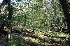
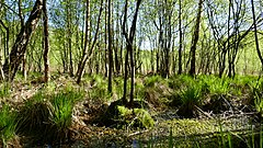
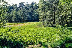
The list of natural monuments in Dötlingen contains the natural monuments in Dötlingen in the Oldenburg district in Lower Saxony .
On December 31, 2016, according to statistics from the Lower Saxony State Agency for Water Management, Coastal Protection and Nature Conservation in the Oldenburg district, there were a total of 346 natural monuments in the area of responsibility of the Lower Nature Conservation Authority .
The lists published by the district of Oldenburg name a total of 354 natural monuments. Of these, 41 are in the area of the municipality of Dötlingen.
Natural monuments
| number | Surname | description | Size / m² | map | image |
|---|---|---|---|---|---|
| ND 101 | Gierenberg | Special slope situation on the edge of the terrace to the Huntetal, sand heather on the hilltop | 24870 | 52 ° 55 '57.3 " N , 8 ° 23' 2.8" E | |
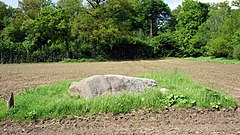
| ND 102 | Witch stone | Boulder with a flattened, visible surface of over 8 m² | 10 | 52 ° 59 '12.1 " N , 8 ° 22' 56.7" E | |
| ND 105 | Oltmann-Berg | Isolated dune close to the river on the east side of the Hunte, dry sand grassland, sand heather | 14583 | 52 ° 57 '35.9 " N , 8 ° 19' 57.7" E | |
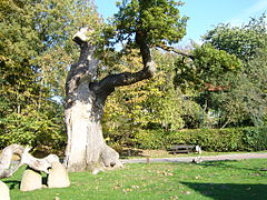
| ND 106 | Village oak Dötlingen | Upright, free-standing torso of a formerly powerful solitary empire, allegedly around 1000 years old | 200 | 52 ° 56 '7.9 " N , 8 ° 22' 50.4" E | |
| ND 107 | Buchenallee Aschenstedt | Age of the mighty beeches approx. 70–110 years, height 20–25 m, trunk circumference 1.85–2.80 m, length of the avenue approx. 450 m, individual gaps | 7500 | 52 ° 56 '3.2 " N , 8 ° 24'25.5" E | |
| ND 108 | Linden-Ulmenallee Ohe | Closed avenue that characterizes the landscape, age of the linden trees approx. 50–90 years, height 16–18 m, trunk diameter 1.24–2.69 m, length of the avenue approx. 200 m | 3800 | 52 ° 58 '43.4 " N , 8 ° 23' 5.9" E | |
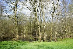
| ND 109 | Bareler Moor | Large, muddy Schlatt; Part of a chain of 3 Schlatts, pre-drained, quarry forest. Located in the middle of agricultural land. | 27516 | 53 ° 0 ′ 5.5 " N , 8 ° 25 ′ 58.9" E | |
| ND 110 | Gerken-Moor | Middle of 3 Schlatts, moored, pre-drained, quarry forest. Located in the middle of agricultural land. | 13040 | 53 ° 0 ′ 13.5 " N , 8 ° 25 ′ 52.8" E | |
| ND 111 | Reinbargsmoor | Schlatt with silting vegetation, partly with peat moss company; marginal use by cow pasture | 6900 | 52 ° 58 '51.2 " N , 8 ° 27' 53.4" E | |
| ND 112 | Haverkamps Schlatt | Schlatt with silting vegetation, on the edge woody vegetation | 11000 | 53 ° 0 '24.4 " N , 8 ° 26" 19.9 " E |

|
| ND 114 | Brandkuhlenmoor | Vermoortes Schlatt with embedded peat cuttings, on the edge woody vegetation | 6400 | 52 ° 59 '12.9 " N , 8 ° 28' 47.4" E | |
| ND 115 | Schierholtsmoor | Schlatt with swamp and water areas as well as a wooded island | 14200 | 52 ° 58 ′ 45.5 " N , 8 ° 27 ′ 41.2" E | |
| ND 116 | Visual bog | Vermoortes Schlatt with embedded peat cuttings, on the edge woody vegetation | 6202 | 52 ° 59 '0.8 " N , 8 ° 28" 8.9 " E | |
| ND 117 | The curly moor | Schlatt with open water, birch break forest | 24775 | 52 ° 57 ′ 35.2 " N , 8 ° 30 ′ 24" E | |
| ND 118 | The little moor | Schlatt with little disruption of the formation of small bogs, adjacent birch forest, coniferous forest, thinned and underplanted with beeches | 35245 | 52 ° 56 '32.3 " N , 8 ° 29' 1.9" E | |
| ND 119 | Witch bed | Boulder measuring 2.5 m × 1.60 m, which is visible at the original site about 70 cm above the surface of the earth. The location is in a forest near the ND 102 (witch stone) | 10 | 52 ° 59 '13.5 " N , 8 ° 22" 44.9 " E | |
| ND 120 | Boulder on the city path | Boulder of approx. 2.7 × 1.8 × 2 m, which was removed from its original location in a field nearby | 10 | 52 ° 57 '14.9 " N , 8 ° 27' 25.9" E | |
| ND 121 | Schlatt near Iserloyer Sand | Moorschlatt with wet, nutrient-rich fen sites and embedded peat cuttings, in which marsh calla is widespread | 13200 | 52 ° 57 ′ 27.5 " N , 8 ° 24 ′ 42.3" E | |
| ND 122 | Lütje Moor | At the edge of the forest, small, very wet, peat moss-rich moor with a lot of cotton grass | 22000 | 52 ° 59 '34.4 " N , 8 ° 27' 57.3" E | |
| ND 123 | Pond near Brettorf | Near-natural water in the area of a former sand pit with cattails and reeds, willow bushes at the edge | 8900 | 52 ° 57 '48.8 " N , 8 ° 28' 28.1" E | |
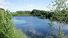
| ND 124 | Tonkuhle Neerstedt | Large, partially recultivated, former clay pit with extraction waters, reeds, willow bushes | 45000 | 52 ° 59 '17.5 " N , 8 ° 23' 22.7" E | |
| ND 125 | Rittrum Mountains | Impressively formed steep edge on the east side of the Hunte with very old, primeval trees (oak and beech) | 62200 | 52 ° 59 '1.4 " N , 8 ° 19' 48.3" E | |
| ND 126 | Eilersche bathing area | North-eastern part of a Hunte oxbow lake and a pond with reed beds and silted vegetation created by damming a watercourse, former bathing area | 18200 | 52 ° 58 ′ 7.8 " N , 8 ° 20 ′ 11.9" E | |
| ND 127 | Black moor | Flat, moored depression in a sandy geest with wet fen, transitional moor and moor locations with near-natural upland moor vegetation, moor meadow, alder and birch forest | 32100 | 52 ° 58 ′ 6.4 " N , 8 ° 20 ′ 43.4" E | |
| ND 128 | Edge of the valley on the Wellohsberg | The edge of the valley, characterized by pressure water, with wet grassland, gale bushes and alder forest, towards the Hunte, dry sandy grassland | 55250 | 52 ° 54 '58.1 " N , 8 ° 25' 1.9" E | |
| ND 129 | Schlatt on the Bareler Berg | Birch quarry forest in a shallow depression with flatly flooded moorland. In the center peat moss cover, occasional cotton grass | 10,000 | 52 ° 59 '38.1 " N , 8 ° 25' 38.5" E | |
| ND 130 | Schlatt at Dötlinger Holz | Wooded moorland with damp to wet locations that have been severely chilled by peat cutting, in the peat cuttings swamp calla | 6300 | 52 ° 56 '49.3 " N , 8 ° 23' 9.2" E | |
| ND 131 | Beech at Dötlinger Holz | Mighty beech tree standing at the edge of the forest with a trunk circumference of 5.3 m, crown diameter approx. 30 m, height 30 m, trunk to crown base 5 m | 750 | 52 ° 56 '34.1 " N , 8 ° 23' 4.6" E | |
| ND 132 | Oak at the Rittrumer Mühlbach | mighty, free-standing old oak, trunk circumference 4 m, height approx. 17 m, crown diameter 24 m, crown attachment 1.7 m high | 500 | 52 ° 58 '55.6 " N , 8 ° 22' 14.9" E | |
| ND 133 | Oak on the sheep pen | Mighty, free-standing old oak, trunk circumference approx. 4 m, crown diameter approx. 20 m, height 20 m, trunk height up to crown base 3.5 m | 350 | 52 ° 57 ′ 47.1 ″ N , 8 ° 28 ′ 19 ″ E | |
| ND 134 | Schlatt near Welsburg | Birch quarry forest in a muddy depression with a closed peat moss cover, in depressions also peat moss swinging grass, in the herb layer both types of cotton grass | 10,000 | 53 ° 0 ′ 46.2 " N , 8 ° 28 ′ 11.8" E | |
| ND 135 | Schlatt Behind the Woe | Very wet birch forest / willow swamp with inaccessible peat cut areas. Often with peat moss, cotton grass and / or ostrich grass swinging lawns | 26100 | 52 ° 59 '48.9 " N , 8 ° 23' 3.7" E | |
| ND 136 | Bog in Rhader Sand | Bog located in the forest with dense peat moss lawns, cotton grass and gray sedge, small areas of inaccessible swinging lawn | 11200 | 53 ° 0 ′ 11.7 " N , 8 ° 24 ′ 44.3" E | |
| ND 137 | Margaretenmoor | Birch forest in a muddy valley | 20200 | 53 ° 0 ′ 35 " N , 8 ° 28 ′ 58.5" E | |
| ND 138 | Schlatt while standing | Schlatt at the edge of the forest with a closed peat moss cover, narrow-leaf cotton grass, sedges and rare peat moss | 7200 | 52 ° 59 '58.3 " N , 8 ° 27' 46.1" E | |
| ND 139 | Black-headed gulls in Brettorf | Larger, near-natural body of water in a muddy basin with a small island as a breeding ground for the black-headed gull | 404 | 52 ° 58 '33.4 " N , 8 ° 26' 52.9" E | |
| ND 140 | Doveschlatt | Round still water in a muddy basin with island-shaped bank areas, which are important as biotopes for the black-headed gull | 33407 | 53 ° 0 ′ 18.4 " N , 8 ° 25 ′ 46.7" E | |
| ND 141 | Wet meadow near Rhade | Moist and wet meadow on both sides of a watercourse, which in addition to rushes, sedges and marsh marigolds also has two types of orchids. | 1150 | 52 ° 59 '30.2 " N , 8 ° 24' 8.1" E | |
| ND 142 | Muckelmann's pond | Bog pond with abundant stocks of feverish clover, swamp calla and other endangered plant species | 9400 | 52 ° 57 '59 " N , 8 ° 20' 40.5" E | |
| ND 143 | Last of the seven beeches | Strangely grown beech with a trunk circumference of 4.3 m, crown base at a height of 1.5 m, crown width 20 m | 350 | 52 ° 57 ′ 14.4 ″ N , 8 ° 22 ′ 22.8 ″ E estimated | |
| ND 144 | Hutewaldrest Seven Beeches | gnarled, old oaks with peculiar growth shaped by grazing as remnants of the former Hutewaldes | 1800 | 52 ° 57 '14.7 " N , 8 ° 22' 24" E |
Web links
Commons : Natural monuments in Dötlingen - collection of images, videos and audio files
- Lower Saxony Ministry for the Environment, Energy and Climate Protection: The nature reserves of Lower Saxony on the interactive environmental map
Individual evidence
- ↑ Number of natural monuments in the area of responsibility of the Lower Nature Conservation Authority ( status: December 31 , 2016) on nlwkn.niedersachsen.de (accessed on November 5, 2017)
- ↑ a b c d e f g h i j k l m n o p q r s t u v w x y z aa ab ac ad ae af ag ah ai aj ak al am an ao Naturdenkmale Doetlingen (pdf, 578 kB; accessed on November 5, 2017)
- ↑ a b c d e f g h i j k l m n o p q r s t u v w x y z aa ab ac ad ae af ag ah ai aj ak al am an Naturdenkmale Dötlingen map ( memento of the original from 4 March 2016 in the Internet Archive ) Info: The archive link was inserted automatically and has not yet been checked. Please check the original and archive link according to the instructions and then remove this notice. (pdf, 1.11 MB; accessed March 31, 2015)
