List of natural monuments in Veringenstadt
| Natural monuments | number |
|---|---|
| FND | 7th |
| END | 8th |
| total | 15th |
The list of natural monuments in Veringenstadt names the prescribed natural monuments (ND) of the town of Veringenstadt, located in the Baden-Württemberg district of Sigmaringen . In Veringenstadt there are a total of 15 objects protected as natural monuments, of which 7 are areal natural monuments (FND) and 8 individual structure natural monuments (END).
As of November 1, 2016.
Areal natural monuments (FND)
| Surname | image | Identifier
|
details | position | Area hectares |
date | |
|---|---|---|---|---|---|---|---|
| Annakapellen cave |

|
84371140001
|
Veringenstadt The Anna-Kapellen-Höhle above Veringenstadt in a rock of the White Jura. The cave was named after the St. Anne's Chapel that used to stand here. The cave entrance faces north. The stele is reminiscent of the St. Anna Chapel, which was built on this site in 1515. The first caretaker was the painter Peter Strüb from Veringenstadt. In 1817 the chapel was demolished. The stele was designed by Ilse Wolf from Inneringen and inaugurated on May 1, 1998. |
⊙ | 0.0 | 1971-05-18 | |
| Felix rocks |

|
84371140009
|
Veringenstadt Felixfelsen in the nature reserve Büttnautal in Veringenstadt. |
⊙ | 0.0 | ||
| Rocks of the Affelstetten ruin |

|
84371140010
|
Veringenstadt rock group on the right side of the Lauchert approx. 200 m after leaving the village in the direction of Jungnau. The 20 m high rock face is approx. 40 m wide and in the upper area still has parts of an old masonry from the Affelstetten ruin. The castle was probably built during the 13th century by the local nobility based in Affelstetten. |
⊙ | 0.0 | ||
| Göpfelstein Cave |

|
84371140004
|
Veringenstadt The Göpfelstein cave lies at an altitude of 660 m above sea level. NN at the western exit of Veringenstadt, right above the Lauchert and the old town. The entrance faces south and is visible from afar in a massive rock of the White Jura. |
⊙ | 0.0 | 1971-05-18 | |
| Semi-dry lawn in Lausert |

|
84371140012
|
Veringenstadt Area with dry as well as damp areas and corresponding vegetation. The area is framed all around with conifers. |
⊙ | 0.3 | ||
| Nicholas Cave |

|
84371140003
|
Veringenstadt The Nikolaushöhle is a karst cave with Paleolithic finds. View from the Nikolaushöhle to the Göpfelsteinhöhle and Veringenstadt opposite. |
⊙ | 0.0 | 1971-05-18 | |
| Zimmer Valley |

|
84371140014
|
Veringenstadt Dry grassland location on the edge of a forest. The grassland area is criss-crossed by sloe and elder bushes as well as individual pine trees. The vegetation typical of a limestone grassland of the Swabian Alb can be found on the warm, dry location. There are signs of leanness and orchids on the surface. |
⊙ | 1.9 | 1992-12-18 | |
| Legend for natural monument | |||||||
Single structure (END)
| Surname | image | Identifier
|
details | position | Area hectares |
date | |
|---|---|---|---|---|---|---|---|
| Sycamore maple |

|
84371140006
|
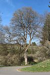
Veringenstadt Old sycamore maple directly on the road with a wide crown and characteristic bark on a trunk measuring approx. 3 m in circumference. The branches hang far down. |
⊙ | 0.0 | 1971-05-18 | |
| Bridal linden tree |

|
84371140008
|
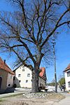
Veringenstadt Alte Linde at the exit Veringendorf towards Jungnau on the right side of the road. Trunk heavily overgrown with moss with a circumference of almost 4 m. A linden tree standing alone is characterized as a bridal linden tree. |
⊙ | 0.0 | ||
| Gallus Spring |

|
84371140011
|
Veringenstadt The Gallus spring or Gallus fountain is a karst spring in the Hermentingen district of Veringenstadt. |
⊙ | 0.0 | 1971-05-18 | |
| Clover |

|
84371140002
|
Veringenstadt The heavily sprinkled beech tree stands on the rock above the Nikolaushöhle. Due to the low depth of the site, the beech has difficult growing conditions and thus developed its special low-growing, sinuous shape. |
⊙ | 0.0 | 1935-03-25 | |
| Linden at the water reservoir |

|
84371140000
|
Veringenstadt Mighty linden tree on the wayside, with a trunk circumference of 3.5 m. At a height of 2 m, the trunk divides into many broad branches and forms a broad crown. The lone tree shapes the landscape. |
⊙ | 0.0 | 1971-05-18 | |
| Linden group with cross |

|
84371140005
|
Veringenstadt Drei Linden to the right and left of a wayside cross. Two trees are very close together. The group connects to a spruce forest to the east. On the other side of the path is another linden tree of similar age. |
⊙ | 0.0 | 1971-05-18 | |
| Blacksmith tree |

|
84371140007
|
Veringenstadt Linden tree in the midst of Veringendorf. The tree has a trunk circumference of approx. 3 m and stands at an intersection. |
⊙ | 0.0 | ||
| Lauchert waterfall "Gieß" |

|
84371140013
|
Veringenstadt The Gieß waterfall in Veringendorf was the largest waterfall in the Swabian Alb in terms of the amount of water and the height of the tufa barrels. The waterfall was significantly affected by the construction of an electrical works in the 1920s. The picture shows the waterfall with the weir open during a flood on May 3, 2015. |
⊙ | 0.0 | ||
| Legend for natural monument | |||||||

