
Masalima Islands
| Masalima Islands | ||
|---|---|---|
| Waters | Java lake | |
| archipelago | Malay Archipelago | |
| Geographical location | 5 ° 3 ′ S , 117 ° 4 ′ E | |
|
||
| Number of islands | 7th | |
| Main island | Saliriang (Masalima) | |

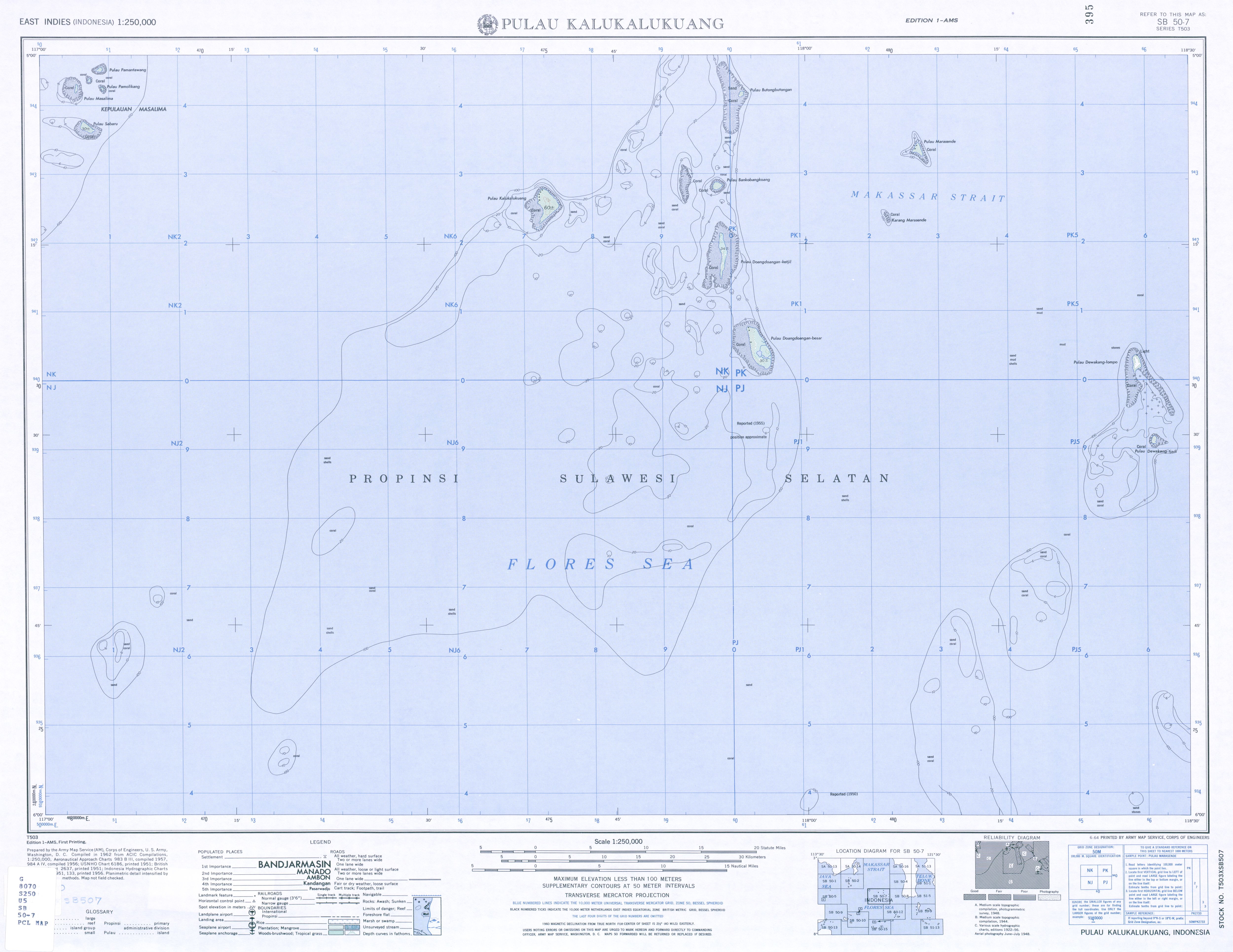
The Masalima Islands ( Indonesian Kepulauan Masalima ) are an Indonesian group of islands in the Java Sea .
geography
The islands lie between Kalimantan (Borneo), Sulawesi (Celebes) and Sumbawa in the Java Sea. The closest neighbors to the east are other small islands such as Kalukalukuang , Doangdoangan Besar and Doangdoangan Kecil , and the Laut-Kecil Islands to the west .
The largest island is Sabaru , in the south of the archipelago. Saliriang (Masalima) is in the northwest, Pamolikang in the northeast and Pamantawang in the north. There is another island and two islets between the three northern islands. All islands are surrounded by coral reefs.
Administratively, the Masalima Islands, like their western neighbors, belong to the district ( Indonesian Kecamatan ) Liukang Kalukalukuang MAS of the administrative district ( Indonesian Kabupaten ) Pangkajene dan Kepulauan of the province of South Sulawesi ( Indonesian Sulawesi Selatan ).
Residents
According to the 2010 census, the administrative village ( Indonesian Desa ) Sabaru , which includes the islands of Sabaru and Pamantawang, has a total of 1,402 inhabitants. 3,128 people live in Desa Pammantauan Masalima , which is formed from the remaining islands.
Individual evidence
- ↑ The Great World Atlas, Millennium House (2009), ISBN 9781921209314 .
- ↑ Map of Kalukalukuang , accessed November 25, 2016.
- ↑ Penduduk Indonesia menurut desa 2010 ( Memento from March 27, 2014 in the Internet Archive ) (Indonesian; PDF; 6.0 MB), accessed on January 26, 2013