Mauensee (body of water)
| Mauensee | ||
|---|---|---|

|
||
| Geographical location | Canton lucerne | |
| Drain | Ron | |
| Places on the shore | Mauensee | |
| Data | ||
| Coordinates | 648 287 / 224 688 | |
|
|
||
| Altitude above sea level | 504 m above sea level M. | |
| surface | 0.55 km² | |
| Maximum depth | 9 m | |
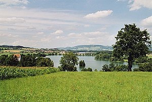
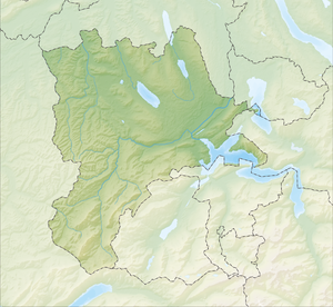
The Mauensee is a 0.55 km² lake in the Sursee district in the Swiss canton of Lucerne .
location
The Mauensee is located on the eastern edge of the Wauwilermoos a good three kilometers west of the larger Sempachersee . The lake has a shore length of 4.2 kilometers. The lake is fed by several small brooks, drained by the Ron , which flows into the Wigger . The Mauensee Castle is located on the largest of the four small islands and is connected to the mainland by a small bridge.
It takes a good three quarters of an hour to walk around the lake. Swimming and fishing are prohibited in the Mauensee.
Mauensee Castle
Mauensee Castle was first mentioned in the years 1184–1190. Later it belonged half to the Habsburgs and half to the Barons von Grünenberg before it passed into the possession of the City Council of Lucerne in 1455 . The current building was built in 1605 by Ludwig Pfyffer von Altishofen . The castle has been private and owned by the Sigg family since 1998 .
Web links
- Mauensee Castle at Zentralplus.ch
- Mauensee on schweizersee.ch

