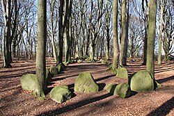
Megalithic systems from Grundoldendorf
| Megalithic systems from Grundoldendorf | ||
|---|---|---|
|
Neolithic large stone grave 4 in the landscape protection area "Im Dohrn" near Grundoldendorf, district of Stade |
||
|
|
||
| Coordinates | 53 ° 28 '15.7 " N , 9 ° 35' 12" E | |
| place | Grundoldendorf , Lower Saxony , Germany | |
| Emergence | 3500-3000 BC Chr. | |
| Sprockhoff no. | 664-667 | |
The megalithic complexes of Grundoldendorf (also called Bliedersdorf 1-4) are west of the village of Grundoldendorf in the municipality of Apensen in the Stade district . In Lower Saxony they represent an ensemble that can at best be compared with the Oldendorfer Totenstatt . The complexes have the Sprockhoff numbers 664 to 667.
description
The complex consists of four large megalithic beds , each of which contains an enlarged dolmen positioned across the longitudinal axis . A fifth giant bed was still present in the 19th century. The form is very old and, in terms of evolution, has only the longitudinal, mostly accessible, ancient dolmen as a forerunner.
The four beds of medium length are located west of the village (towards Bliedersdorf) in the light beech grove called the Dohrn. Their borders are still largely complete. The extended dolmens originally had two cap stones, but these are only present in chambers I and IV. One is missing from Chamber II and both are missing from Chamber III, so that five of the original eight (or nine) are present. In Annex III, the bearing stone pattern indicates that three cap stones may have been placed here. Beds I to III are in a north-west-south-east facing row, while No. 4 is located 30 meters parallel to the south-east. The three formation has a total length of approx. 120 meters. The entrances to chambers III and IV are in the northeast, the other two in the southwest.
Annex I is the longest and best preserved at 51 meters. 75 boulders form its border. Only the chamber in bed I is almost in the middle of the bed length. The other three are more or less offset towards the ends. The floor was paved with rounded rubble stones and lay on a layer of ash that dates back to 2845 BC. Chr. (Uncalibrated) made possible. The bones and additions found are reburials and date from the Bronze Age . Some capstones show bowls . During the excavation in 1905, Carl Schuchhardt found stone pavements of around 2.5 square meters within Annexes I and II without any further findings. Chamber III contained a beaker made of corded ceramics and a clay spoon.
At the moment (autumn 2017) the Dohrn is closed because several of the beech trees, which are up to two hundred and fifty years old, threaten to topple over. According to information from district spokesman Christian Schmidt, the area belongs to the district, the state of Lower Saxony and the municipality of Apensen. All three owners now want to sit down and clarify how to proceed with the forest, which is also a valuable bat habitat. The salvage of already fallen beech trees was complex and very costly, since the stone graves must not be affected.
See also
literature
- Jürgen Deichmüller: The giant beds near Grundoldendorf. In: Guide to Prehistoric and Protohistoric Monuments. Volume 30. The Elb-Weser Triangle II: Research Problems - Excursions: Stade · Zeven · Bremervörde · Buxtehude. Verlag Philipp von Zabern, Mainz 1976, ISBN 3-8053-0145-6 , pp. 149-155.
- Ernst Andreas Friedrich : The giant beds of Grundoldendorf. In: If stones could talk , Volume III, Landbuch-Verlag, Hannover 1995, ISBN 3-7842-0515-1 .
- Daniel Nösler, Erected by Hünen? In: Daniel Nösler u. Andreas Schäfer (ed.), Lost property. Archeology between the Oste and the Elbe. MCE-Verlag, Drochtersen 2013, pp. 38–39.
- Heinz Schirnig (Ed.): Great stone graves in Lower Saxony . Lax, Hildesheim 1979, ISBN 3-7848-1224-4
Web links
• Uwe Ruprecht: A place with aura. The Grundoldendorf megalithic complex


