
Mianwali
|
Mianwali مِيانوالى |
|||
| State : |
|
||
| Province : | Punjab | ||
| Coordinates : |
32 ° 35 ' N , 71 ° 33' E
|
||
| Height : |
210 m
|
||
| Residents : | 118,883 (2017 census) | ||
| Time zone : |
PST ( UTC + 5 )
|
||
|
|||

Mianwali (Urdu: ميانوالى) is the capital of the Mianwali district in the province of Punjab in Pakistan .
history
Before British rule, the area was an integral part of the Greco-Bactrian Empire . Immediately before the British annexed Punjab after the First Sikh War , this area was part of the Sikh Empire . During British rule, India was divided into provinces, divisions, and districts. The British had made the city of Mianwali the headquarters of the Bannu district , which was then part of the Dera Ismail Khan division in the Punjab province. Mianwali is now the administrative center of the Mianwali district of the same name. The population of Mianwali was 3591 according to the 1901 census in India. Mianwali has now grown into a big city.
Population development
| Census year | population |
|---|---|
| 1901 | 3,591 |
| 1972 | 48,304 |
| 1981 | 59,159 |
| 1998 | 80.171 |
| 2017 | 118,883 |
gallery
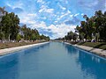
Canal in Mianwali

Individual evidence
- ↑ Pakistan: Provinces and Major Cities - Population Statistics, Maps, Charts, Weather, and Web Information. Retrieved March 20, 2020 .