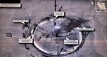
Military satellite

Military satellites are satellites that are used for military purposes. The tasks of such satellites originally include communication, observation and orientation. Such satellites are maintained by all major nations that have the opportunity to launch such satellites.
As early as 1959, the USA began to launch spy satellites (code name Corona ), the images of which had a resolution of about 7.5 meters and which brought their images back to Earth by exposing film canisters. The digital age began here from around 1976 . The resolution at this point in time was about 15 centimeters. Today's resolutions are said to be ten to under four centimeters.
Military communications satellites are used in global armies to transmit commands and information. Current representatives of this category are z. B. the US Milstar satellites, six of which have been launched into space since 1994.
Finally, positioning and navigation is another area of application for military satellites. For this purpose the USA developed the Global Positioning System . This allows a relatively precise determination (10 m) of troop units, but is also used to control cruise missiles. The signals from these satellites are now also used for civil navigation, but can also be encrypted in times of crisis, so that the general accuracy deteriorates or the system fails completely. This led to the development of positioning and navigation systems ( Galileo ) initially intended for purely civilian purposes .
A future area could be armed satellites or satellites used as weapons. As early as 1983 under Ronald Reagan , the US started the Strategic Defense Initiative , which was discontinued in 1993 due to major technical problems and high costs. Under the administration of George W. Bush , the program was revived and tackled again. it is now called National Missile Defense . This relies on both ground-based interceptor missiles and other defense systems such as high-energy lasers ( e.g. airborne lasers ) as well as space weapons .
Some commercial and research satellites are also used for military purposes in dual-use mode. Examples of this are the GPS satellite satellites and high-resolution earth observation satellites such as Landsat .
literature
- Josef Gerner: The range of information and services that can be used by the military on earth satellites. in: Information from space - the new dimension of combat. Mittler, Herford 1990, ISBN 3-8132-0336-0 , pp. 18-80.
Web links
- Gary Federici: From the Sea to the Stars: A History of US Navy Space and Space-Related Activities (english)
Individual evidence
- ↑ Marco Langbroek: Image from Trump tweet identified as imagery by USA 224, a classified KH-11 ENHANCED CRYSTAL satellite. September 1, 2019, accessed September 2, 2019 .

