Minakami (mountain)
| Minakami | ||
|---|---|---|
| height | 659 m TP | |
| location | Nagano , Japan | |
| Coordinates | 36 ° 33 '10 " N , 138 ° 13' 10" E | |
|
|
||
| Type | Lava dome | |
| rock | Andesite | |
| Age of the rock | 300,000-350,000 years | |
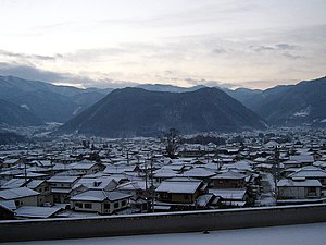
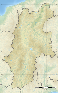
The Minakami ( Japanese 皆 神山 , -yama ) is a 639 m high lava dome in Matsushiro , Nagano .
description
The Andesite Lavadom is located in the southeast of the Matsushiro district of Nagano on the edge of the Nagano Basin and has a diameter of just over one kilometer. Using potassium-argon dating , the age of the lava dome was determined to be 300,000 to 350,000 years. It was created by the slow rise of lava, which then cooled down. This gave the mountain its largely flat shape, which, however, is slightly lowered in the middle. It has two peaks: the one in the southwest is 642.8 m high and the one in the northeast 659 m. The lava below the cathedral is 150 m thick.
From August 1965 to December 1966 he was in the center of the Matsushiro swarm of earthquakes ( 松 代 群 発 地震 , Matsushiro gunpatsu jishin ), which resulted in arching of the ground, crevices and the emergence of water sources.
With the advance of US troops in the Pacific War , the Japanese military leadership decided at the end of 1944 to set up the Matsushiro Daihon'ei (Imperial Headquarters Matsushiro) as an underground bunker complex in the mountains of Matsushiro . The tunnels in Minakami were intended to serve as a residence for the imperial family .
Cultural meaning
Due to its unusual shape, the mountain has been particularly valued since time immemorial. It used to be considered a holy mountain and was worshiped by Shugendo monks. In modern times it is seen in esoteric circles as an ancient man-made pyramid, and every year on May 5th the pyramid festival ( ピ ラ ミ ッ ド 祭 り , piramiddo matsuri ) takes place at the summit .
Natural and cultural monuments
The ponds on the mountain top serve as the spawning grounds of the dark angular newt ( Hynobius nigrescens ) and have therefore been a natural monument of the city of Nagano since November 1, 1967.
On the mountain is the Kumanoizuhayao Shrine ( 熊 野 出 速 雄 神社 ), commonly known as the Minakami Shrine ( 皆 神 神社 ), the actual date of its foundation is unknown, the main hall ( honden ) being from the Muromachi period and since 15. August 1994 is recognized as a prefecture treasure. There are also Buddha statues in the shrine of Dainichi Nyorai (Mahāvairocana), Amida Nyorai (Amitābha) and Miroku Bosatsu (Maitreya) from 1507, which were placed under monument protection by the city of Nagano on January 20, 1993.
Individual evidence
- ↑ a b c d 皆 神 神社 ・ 歴 史 ・ 観 光 ・ 見 所 . In: 長野 県 WEB 観 光 案 内 所 . Retrieved January 9, 2011 (Japanese).
- ↑ a b Yukio Hayakawa: 皆 神山 . In: 火山 の 噴火 史 . Retrieved January 9, 2011 (Japanese).
- ↑ a b c d 渡 辺 佳美 : お ま ん じ ゅ う の よ う な 山 ―― 皆 神山 . Retrieved January 9, 2012 (Japanese).
- ↑ Height information according to the official topographical map
- ↑ (7) The Matsushiro earthquake swarms. 地震 調査 研究 推進 本部 , accessed on January 9, 2011 (English).
- ↑ WWII Imperial Headquarters - Matsushiro. In: Japan Travel Guide. The Yamasa Institute, accessed January 9, 2012 .
- ↑ 長野 市 や ま ざ と 振興 計画 . Nagano, p. 21 , accessed January 9, 2011 (Japanese).
- ↑ a b 皆 神山 の ク ロ サ ン シ ョ ウ ウ オ 産卵 池 . Nagano City, Retrieved September 1, 2016 (Japanese).

