Miramar Peninsula
| Miramar Peninsula | ||
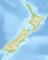
 Miramar Peninsula (on the left) |
||
| Geographical location | ||
|
|
||
| Coordinates | 41 ° 18 ′ 0 ″ S , 174 ° 49 ′ 0 ″ E | |
| location | Wellington , North Island , New Zealand | |
| Waters 1 | Wellington Harbor | |
| length | 3.6 km | |
| width | 1.5 km | |
The Miramar Peninsula is a peninsula at the southeast end of the city of Wellington in New Zealand . On it are the suburbs of Miramar , Maupuia, Seatoun , Strathmore and The Heights.
An isthmus connects the peninsula with the rest of Wellington. Wellington Airport is also on it . The peninsula separates the Wellington Harbor belonging Evans Bay in the north of the Lyall Bay and Cook Strait in the south.
In the east of the peninsula lies the mouth of Wellington Harbor . Barrett Reef, notorious for its numerous shipwrecks, is located off the coast of the peninsula.
The peninsula was originally called Watt's Peninsula by the European settlers . In 1872 the first settler in the area, James Coutts Crawford, renamed it Miramar . The Māori name for the peninsula is Whataitai .
The film effects companies Weta Workshop , Weta Digital , and the post-production company Park Road Post Production , among others, are based on Miramar .
