Moho Caye
| Moho Caye | ||
|---|---|---|
| Waters | Caribbean Sea | |
| Geographical location | 17 ° 31 ′ 30 ″ N , 88 ° 12 ′ 0 ″ W | |
|
|
||
| length | 400 m | |
| width | 200 m | |
| surface | 4.856 ha | |
| Residents | uninhabited | |
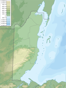
Moho Caye is an island off the coast of Belize . It is one of the 450 islands of the Belize Barrier Reef . Administratively it belongs to the Belize District .
geography
Moho Caye is about 500 meters from Belize City, at the eastern end of Buttonwood Bay, north of the University Heights district. The island is roughly rectangular in shape, with two horseshoe-shaped foothills encircling a bay that houses a harbor. The interior of the island is traversed by a U-shaped channel that is widened at the southern end.
To the east of Placencia is another island called "Moho Caye". There is a resort called Moho Caye Lodge near Punta Gorda , which has nothing to do with the islands.
history
The island used to be a quarantine station for victims of smallpox and other infectious diseases. A cemetery commemorates this time. Moho Caye is now privately owned and houses holiday homes.
Individual evidence
- ↑ Harry S. Pariser: Explore Belize, p. 135. Hunter, 1997
