Montlake Cut
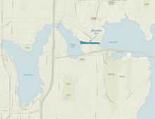
The Montlake Cut is the easternmost part of the Lake Washington Ship Canal , which crosses the city of Seattle and connects Lake Washington with the Puget Sound . It is approximately 2,500 ft (800 m) long and 350 ft (110 m) wide. The central canal is 100 ft (approx. 30 m) wide and 30 ft (approx. 10 m) deep. The path along the cut was declared in 1971 as the Montlake Cut National Waterside to the National Recreation Trail .
The cut enables a connection between Union Bay , part of Lake Washington, to the east and Portage Bay , an arm of Lake Union , to the west. It is crossed by the Montlake Bridge, a bascule bridge ( drawbridge ) over which Montlake Boulevard ( Washington State Route 513 ) runs. Most of the land at the north end of the cut is occupied by the University of Washington , to the west by the Medical School, and to the east by the stadium parking lot; Residential buildings and a walkway occupy the south side as part of the Montlake district. The neighborhood is home to the annual Windermere Cup , a rowing regatta , and Seattle Yacht Club's Opening Day Boat Parade , both of which take place on the first Saturday in May.
The cut lowered the lake's water table by 8.8 ft (2.7 m) and drained the wetlands around the lake; the lowering particularly affected the outflow over the Black River (at the southern end of the lake in Renton).
The original name of the Montlake Cut was Erickson Cut. Entrepreneur CJ Erickson started the big project when he turned on his large steam excavator during an opening ceremony on October 27, 1909. This happened after the 1909 World's Fair ("Alaska-Yukon-Pacific Exposition") as the last stage in the completion of the Lake Washington Ship Canal. In attendance were Judges Roger S. Greene, Judges Thomas Burke, JS Brace and John H. McGraw, who broke ground that day.
The Duwamish called the area "carrying a canoe" ( Lushootseed : sxWátSadweehL). The Indians had carried their canoes across the country between lakes for centuries, or had used a temporary stream that carried water when Lake Washington overflowed.
"The Cut" is home to the University of Washington Rowing Teams , where the last 500 meters of the 2,000 meter long race course are located.
Individual evidence
- ^ Montlake Cut National Waterside . American trails. May 15, 2013. Retrieved August 14, 2014.
- ↑ Jennifer Ott: Montlake Cut (Seattle) . HistoryLink.org . December 30, 2012. Accessed May 30, 2018.
- ^ Coll Thrush: Native Seattle: Histories from the Crossing-Over Place . University of Washington Press, 2007, ISBN 0-295-98700-6 , p. 251.
Web links
47 ° 38 ′ 50 " N , 122 ° 18 ′ 3" W 47 ° 38 ′ 51 " N , 122 ° 18 ′ 32" W.


