Monts Otish
| Monts Otish | ||
|---|---|---|
|
View over the Rivière Eastmain to the Monts Otish |
||
| Highest peak | Mont Yapeitso ( 1135 m ) | |
| location | Québec (Canada) | |
|
|
||
| Coordinates | 52 ° 19 ′ N , 70 ° 36 ′ W | |
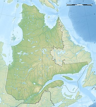
The Monts Otish form a mountain range in the center of the Labrador Peninsula in the Canadian province of Québec . The highest point is Mont Yapeitso , 160 km northeast of Lac Mistassini , at 1135 m. The mountain range extends from 50 km to 20 km. Alpine vegetation predominates on the peaks.
Several larger rivers have their origin in the mountains: Rivière Eastmain in the west, Rivière Témiscamie , Rivière Péribonka and Rivière aux Outardes in the south.
Individual evidence
- ^ Commission de toponymie du Québec - Monts Otish

