Morant Cays
| Morant Cays | ||
|---|---|---|
| Satellite image of the Morant Cays | ||
| Waters | Caribbean Sea | |
| Geographical location | 17 ° 24 ′ N , 75 ° 59 ′ W | |
|
|
||
| Number of islands | 4th | |
| Main island | Northeast Cay | |
| Total land area | 0.16 km² | |
| Residents | uninhabited | |
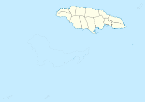
The Morant Cays are a group of small islands in the Caribbean Sea . They are located about 51 km southeast of Morant Point and represent the eastern land mass of Jamaica . The Morant Cays were annexed by the United Kingdom in 1862 and added to Jamaica in 1882.
administration
The Morant Cays, like the Pedro Cays , which are still further away from the coast , are administratively counted as part of Kingston Parish .
geography
The group consisting of four cays has a coral bank about 100 km² in size and 7 km long as its foundation . Sea birds and turtles breed on the cays. On behalf of the Jamaican Ministry of Fisheries, a lighthouse and shelters were built on the northeastern Cay for fishermen who occasionally collect guano and fish here .
The islands from north to south are Northeast Cay (6.8 acres), Northwest Cay (1.2 acres), Southeast Cay (6.2 acres), and Southwest Cay (1.8 acres).
Individual evidence
- ↑ Archived copy ( memento of the original dated November 10, 2011 in the Internet Archive ) Info: The archive link was inserted automatically and has not yet been checked. Please check the original and archive link according to the instructions and then remove this notice. Morant and Pedro Cays Act, 1907
- ↑ [1] ( Page no longer available , search in web archives ) Info: The link was automatically marked as defective. Please check the link according to the instructions and then remove this notice. Area information estimated on the basis of the scale detailed map
Web links
- Short information about the group (English)
- Photo and more information (english)
- cards

