Morne Rouge
| Morne Rouge | ||
|---|---|---|
| height | 373 m | |
| location | Dominica | |
| Coordinates | 15 ° 12 ′ 51 ″ N , 61 ° 20 ′ 12 ″ W | |
|
|
||
| Type | Stratovolcano | |
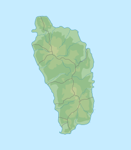
Morne Rouge , together with its second peak, Morne Fous, is a volcanic mountain on the southern tip of the island state of Dominica . Morne Rouge only reaches a height of 373 m , but is very conspicuous due to its location and forms the end of the Soufrière Ridge to the south. The boundary between the parishes of Saint Mark and Saint Patrick runs across its summit.
geography
The mountain stands at the southernmost tip of the island and rises straight out of the sea. The southern flank is very steep, while the landscape slopes more gently to the north. The Petit Coulibri Estate is on the north side.
Together with the Morne Crabier , it is one of the southernmost mountains of Dominica.
literature
- AL Smith, MJ Roobol, GS Mattioli, JE Fryxell, GE Daly, LA Fernandez: The Volcanic Geology of the Mid-Arc Island of Dominica. [Geological Society of America Special Paper; Vol. 496] Geological Society of America 2013. ISBN 0813724961 , 9780813724966
