Mount Burr Range
| Mount Burr Range | |
|---|---|
|
Summit of Mount Burr |
|
| Highest peak | Mount Burr |
| location | South Australia |
| Coordinates | 37 ° 34 ′ S , 140 ° 25 ′ E |
The Mount Burr Range is a volcanic mountain country with 15 geological formations, which is located in the southwest of South Australia and is part of the Newer Volcanics Province .
geology
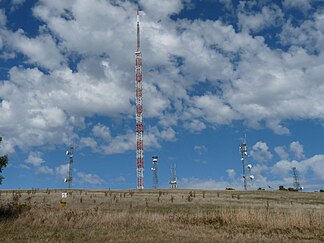
The mountainous country contains the eponymous Mount Burr , a cinder and ash cone , which is the highest mountain in the mountainous country and at the top of which there are systems for the transmission of radio, television and telecommunications, as well as for fire monitoring.
In addition, there is Mount Graham (consisting of lava and volcanic ash), Campbell Hill (volcanic ash dome), Boyce Hill and Mount Lyon (both ash craters), The Bluff (composed of cinder and lava), Mount Lookout in the mountain area (Volcanic ash crater), Mount Frill (volcanic ash dome) and Mount Muirhead . The Mount McIntyre emerged from lava to a seven-kilometer column, there are at both ends cinder cones. At the eastern end of the fisur there is a swampy maar . The Mount Watch is a Schlackendom and formed the area around the mountain The Bluff .
The volcanic elevations are badly eroded . At the time of the eruptions, the mountainous country was on the shores of an ocean from the Pleistocene , which with its waves and sea breezes left traces on the western flanks of the mountains.
The volcanoes of the mountains are older than the nearby volcanoes of Mount Gambier and Mount Schank and formed between 20,000 and 2 million years ago.
Dream time
In the Dreamtime of the Aborigines of Boandik the mountain area of the furnace of their creation beings, the giant Graitbull was.
reachability
The mountains are approximately 20 km from Millicent and can be accessed from Kalangadoo . Some of the mountains are not accessible via roads and are privately owned, but they can still be hiked. There is an observation deck on Mount Muirhead , approximately 6 km from Millicent.
On days of high risk from bushfires , entry into the mountainous region is prohibited.
Individual evidence
- ↑ kanawinkageopark.org.au ( Memento of the original from April 12, 2013 in the Internet Archive ) Info: The archive link was inserted automatically and has not yet been checked. Please check the original and archive link according to the instructions and then remove this notice. (PDF; 668 kB): Mount Burr Range , in English, accessed on January 21, 2012
