Newer Volcanics Province


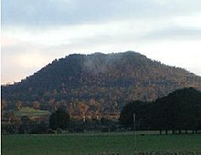
The Newer Volcanics Province is a 23,000 km² volcanic complex, which extends mainly over southwestern Victoria and, to a lesser extent, into southeastern South Australia . It is the largest volcanic complex in Australia and covers 10.36% of the area of the state of Victoria.
The complex comprises over 400 volcanoes that are less than 7 million years old, most of which were formed by the influence of the East Australia Hotspot over southeastern Australia 4.5 to 2 million years ago. However, numerous volcanoes were changed or destroyed by the influence of humans in the course of European settlement through the construction of quarries, agriculture and settlement.
In the field of Province there are six sites of the UNESCO - World Heritage and 14 national parks . The geological history left significant evidence from the Tertiary to the Quaternary . As a result of numerous volcanic eruptions, lava flowed over the landscape that existed at that time, in valleys, into the sea and formed numerous volcanic craters and landscapes.
Culture
Many of the volcanic eruptions are attested by the Aborigines in their oral traditions and in their dream time, who have lived there for 45,000 years. They used volcanic material to make stone tools and weapons, built canals and weirs out of volcanic rocks to breed and catch fish. The Gunditjmara built stone huts on Lake Condah , making them the only indigenous tribe in Australia to build solid structures out of stone.
Examples
Some examples of volcanoes and maars in the Newer Volcanics Province are:
- Lake Bulls Merri
- Mount Buninyong
- Mount Eccles
- Mount Elephant
- Mount Fraser
- Mount Gambier
- Tower Hill
- Mount Kooroocheang
- Mount Leura
- Mount Napier
- Mount Noorat
- Lake Purrumbete
- Red rock
- Mount pub
- Mount Warrenheip
Web links
- vro.dpi.vic.gov.au : Location map of the known volcanic eruptions in the Newer Volcanics Province
- Newer Volcanics Province in the Global Volcanism Program of the Smithsonian Institution (English)
Individual evidence
- ↑ a b Kanawinkageopark.org.au ( Memento of the original from April 12, 2013 in the Internet Archive ) Info: The archive link was inserted automatically and has not yet been checked. Please check the original and archive link according to the instructions and then remove this notice. (PDF file; 653 kB): Kanawinka Global Geopark , in English, accessed on January 21, 2012
- ↑ a b iprimus.com.au : Volcanoes and Earthquakes , in English, accessed January 20, 2012
- ↑ vro.dpi.vic.gov.au : Eruption Points of Newer Volcanics , in English, accessed on January 20, 2012
Coordinates: 37 ° 46 ′ 12 ″ S , 142 ° 30 ′ 0 ″ E

