Mount Butler
| Mount Butler | ||
|---|---|---|
|
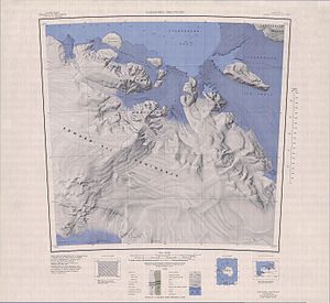
Topographic map (1: 250,000) of the Edward VII Peninsula with Mount Butler (bottom left) |
||
| location | Ross Dependency , Antarctica | |
| Mountains | Rockefeller Mountains | |
| Coordinates | 78 ° 10 ′ 0 ″ S , 155 ° 17 ′ 0 ″ W | |
|
|
||
Mount Butler is a mountain in the Ross Dependency of Antarctica . It rises on the Edward VII Peninsula as the southernmost peak of the Rockefeller Mountains .
It was discovered on January 27, 1929 during an overflight on the first Antarctic expedition (1928–1930) of the American polar explorer Richard Evelyn Byrd . The designation took place in the United States Antarctic Service Expedition (1939-1941), also led by Byrd . It is named after the American cartographer Raymond Archibald Butler (1906–1982), who was involved in the construction of a seismic station in the Rockefeller Mountains on the last research trip in December 1940 .
Web links
- Mount Butler in the Geographic Names Information System of the United States Geological Survey (English)
- Mount Butler on geographic.org (English)

