Mount Olav
| Mount Olav | ||
|---|---|---|
|
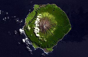
Satellite image of the island with the volcano |
||
| height | 1967 m | |
| location | Tristan da Cunha | |
| Coordinates | 37 ° 6 ′ 0 ″ S , 12 ° 17 ′ 0 ″ W | |
|
|
||
| Type | Volcanic cone | |
| particularities | second highest peak in the South Atlantic | |
The Mount Olav (rarely Olaf ) on the island of Tristan da Cunha is with a height of 1967 m the second highest mountain peaks of the British overseas territory .
This is connected by a ridge to the highest point in the South Atlantic , Queen Mary's Peak . It is the only volcanic cone ( cone ) that forms an active shield volcano with this and other peaks (all cinder or ash cones made of pyroclastic sediment ) .
Web links
- Mount Olav in the Global Volcanism Program of the Smithsonian Institution (English)
Individual evidence
- ↑ a b Definitions and Subfeatures, Tristan da Cunha. Global Volcanism Project, National Museum of Natural History, Smithsonian Institute. Retrieved September 6, 2016.
- ^ Saint Helena - Highest Mountains. GeoNames.org. Retrieved September 6, 2016.
- ^ A guide to the Tristan da Cunha Volcano. The Tristan da Cunha website. Retrieved September 6, 2016.

