New York State Route 437

|
|
|---|---|
| Basic data | |
| Overall length: | 0.48 km / 0.30 mi. |
| Opening: | January 1, 1970 |
| Starting point: |
|
| End point: |
|
| County: | Cayuga County |
The New York State Route 437 ( NY 437 ) is a only 480 meters long State Road south of Auburn in Cayuga County , New York in the US. It serves as the link between NY 38 and NY 38A and is known locally as White Bridge Road. The road allows motorists quick access to nearby Owasco Lake and avoids crossing the Owasco Outlet further downstream in the center of town. NY 437 was not officially established until 1970, but the street number appeared on street maps two decades earlier.
Route description
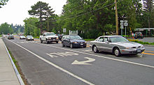
NY 437 adjacent to St. Joseph Cemetery on a roundabout of NY 38 in the Town of Fleming , south of Auburn. It leads as White Bridge Road to the east and runs at the northern end of Owasco Lake . In the middle of its short route, the route crosses the Owasco Outlet and arrives at Owasco , where it leads through Emerson Park, which is maintained by Cayuga County . The route eventually ends about 180 feet further at a T-shaped junction with NY 38A in an area of Owascos known as Melrose Park . NY 437 opens up an undeveloped, forested area west of the lake drain and a residential area east of the body of water. The State Route is approximately 480 m long, making it the shortest signposted state route in the state.
NY 437 is one of the few state-maintained highways with one end at a roundabout. Among them are NY 635 in neighboring Onondaga County , which ends at the intersection with NY 298 and Exit 35 of the New York State Thruway at Carrier Circle , a large roundabout in Syracuse , and NY 140 west of Albany , whose west end is a roundabout the NY 85 forms. Interstate 587 ends outside Kingston at a roundabout with NY 28 and Exit 19 of the New York State Thruway. Also NY 27 appears in the east on Montauk Point in a roundabout to end, but in fact it is a loop of the highway that leads back to itself, similar to US Highway 9 near the Canadian border .
history
NY 437 was expanded to the level of a state route in several phases at the beginning of the 20th century. The section between today's roundabout and the outflow of the lake was rebuilt in 1908 as part of what was then State Highway 384 (SH 384). Between the outflow and today's NY 38A, the conversion took place between 1912 and 1913 as part of SH 752. Both numbers were only used internally within the framework of the law and were not signposted in nature. NY 437 was first used as a designation on contemporary maps of the area in 1947; officially, this street number was not assigned by the New York State Department of Transportation (NYSDOT) until January 1, 1970.
Intersections
| location | mile | km | direction | annotation |
|---|---|---|---|---|
| Fleming | 0.00 | 0.00 |
|
Roundabout |
| Owasco | 0.30 | 0.48 |
|
Census-designated place Melrose Park |
supporting documents
- ↑ Google Maps (in English). overview map of NY 437 [map]. Retrieved August 15, 2012.
- ↑ a b 2008 Traffic Data Report for New York State ( English , PDF) New York State Department of Transportation . June 16, 2009. Retrieved August 15, 2012.
- ↑ Google Maps (in English). Carrier Circle [map]. Retrieved August 15, 2012.
- ↑ Google Maps (in English). Elsmere, New York [map]. Retrieved August 15, 2012.
- ↑ Google Maps . Kingston, New York [map]. Retrieved February 17, 2011.
- ↑ Google Maps (in English). Montauk Point, New York [map]. Retrieved August 15, 2012.
- ↑ Google Maps (in English). Champlain, New York [map]. Retrieved August 15, 2012.
- ^ New York State Department of Highways: Report of the State Commissioner of Highways ( English ). JB Lyon Company, Albany, New York 1920, pp. 222, 238 (accessed August 15, 2012).
- ^ State of New York Department of Public Works (1926) (in English). Official Map Showing State Highways and other important roads [map]. Cartography by Rand McNally and Company .
- ^ Sinclair Oil Corporation (1947) (in English). New York Road Map and Pictorial Sight-Seeing Guide . Cartography by Rand McNally and Company.
- ↑ State of New York Department of Transportation : Official Description of Touring Routes in New York State ( English , PDF; 4.9 MB) January 1, 1970. Retrieved on August 15, 2012: “NY 437 is a new number assigned to connect Routes NY 38 and 38A south of Auburn. "
