
Naissaar
| Naissaar | |
|---|---|
 |
|
| Waters | Gulf of Finland |
| Geographical location | 59 ° 33 '48 " N , 24 ° 30' 55" E |
 |
|
| surface | 18.6 km² |
| Highest elevation | Kunilamägi 27 m |
Naissaar (German Nargen , Swedish Nargö ) is an island in the Gulf of Finland belonging to Estonia .
location
Naissaar is located around 8 km north of mainland Estonia. The island covers an area of 18.6 km². The highest point is the Kunilamägi at 27 meters. In 1934 the island still had 450 inhabitants, today it is almost uninhabited. Naissaar is located at the entrance to Tallinn Bay and was therefore of great strategic importance in the past.
Naissaar can be reached by ferry from the Tallinn fishing port (est. Kalasadam ) in about an hour.
history

The name of the island means "women's island". Naissaar may also be the island mentioned in the Chronicle of Adam of Bremen (around 1075) as Terra feminarum . It has been permanently inhabited since the 15th century at the latest. It was the easternmost settlement area of the Estonian Swedes ; later Estonians also settled there. Because of its strategically favorable location, it has been used for military purposes since the First Northern War and was expanded by Sweden into a fortress. In 1788 the first lighthouse was built. The current lighthouse was built in 1960 and is 47 m high. The largest fortifications on the island date from the time of Russian rule before the First World War and belonged to the sea fortress of Emperor Peter the Great . This also includes the Naissaar narrow-gauge railway from the northern to the southern tip of the island.
In 1917 Naissaar got caught up in the turmoil of the Russian Revolution . Estonia had been granted a certain autonomy under Russian suzerainty by the tsarist government in April 1917 . The Maapäev , the provisional government, found itself exposed to the Bolshevik rebels after the October Revolution. In December 1917 mutinous sailors took control of the island and proclaimed a council republic , the council republic of Nargen ( Naissaare Nõukogude Vabariik ). This miniature state - no more than 90 sailors - existed for just under three months. Estonia declared independence on February 24, 1918, but was immediately occupied by German troops. On February 26th, the revolutionary sailors fled the German advance by sea.
1920–1940, the island belonged to the now independent Estonia and, like the entire country, became Soviet in 1940. In 1941–44, after the attack on the Soviet Union , the Wehrmacht occupied Naissaar. In 1944, most of the Swedes fled the advance of the Red Army across the Baltic Sea to Sweden. After the Second World War , the Soviet Union built the largest mine factory in the entire Baltic Sea region on the island and the island was a restricted military area until 1991. Even today, as a result of the armaments industry, many soils are heavily polluted with oil and heavy metals. After Estonia gained independence, the Red Army left the island.
In 1995 it was converted into a nature reserve. It should be made accessible to gentle tourism, and so the wooden houses of the old Swedish villages were restored. Part of the narrow-gauge railway was also put back into operation.
On August 10, 2005, a helicopter belonging to the Finnish airline Copterline crashed into the sea east of the island . All 14 helicopter occupants were killed in the accident.
In 1879 the optician Bernhard Schmidt was born on Nargen .

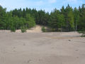
At the beach

Small boat harbor
The Kunilamägi Survey
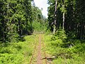
The narrow-gauge railway

Sea mines on the beach


literature
- Heino Gustavson: Mõnda Naissaarest. Varrak, Tallinn 1994, ISBN 9985-807-27-8 .
Web links
Individual evidence
- ↑ Sõidugraafik Naissaarele, hinnad, ekskursioonid, majutus. Retrieved June 2, 2018 (et-EE).