Nancowry
| Nancowry | ||
|---|---|---|
| Waters | Indian Ocean | |
| Archipelago | Nicobar Islands | |
| Geographical location | 7 ° 59 ′ N , 93 ° 32 ′ E | |
|
|
||
| length | 12 km | |
| width | 7.3 km | |
| surface | 66.9 km² | |
| Highest elevation | 162 m | |
| Residents | 1111 (2001) 17 inhabitants / km² |
|
| main place | Malacca | |
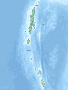
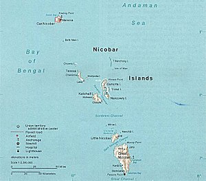
| Map of the Nicobar Islands, Nancowry in the center | ||
Nancowry (also Nankauri, Nancowrie, Nangkowry, Nicobar : Mout ) is an Indian island and one of the Nicobar Islands in the Indian Ocean .
It is located south of the neighboring island of Camorta and east of Katchal , and reaches a height of 162 meters. According to the Indian census in 1991, 941 people lived on the island, the largest villages were: Malacca , Tapong , Champin and Hinnunga . At that time the island had an area of 66.9 km².
An ideal natural harbor stretches between Nancowry and Camorta, which has been described as one of the safest natural harbors in the world and was known to Europeans as early as the 17th century. Pirates also frequently used this port until the English secured it with a base in 1869.
In 1711 French Jesuits tried to settle on the island. From 1756 the Danes claimed the Nicobars and in 1768, with their benevolence, Moravian missionaries landed on Nancowry. In 1778 an Austrian warship, the frigate Joseph and Maria Theresia under Captain Bennet, reached the Nicobars and took possession of Nancowry for Austria . A jump was created and equipped with eight cannons. After it became known, the Danes protested against this practice in their Trankebar base . In 1785 the Europeans left the islands again. In 1869, after the Danes had finally given up their claims, the English established a settlement with about 350 inhabitants in the port of Nancowry.
In the great tidal waves of the tsunami as a result of the severe seaquake in the Indian Ocean in 2004 , Nancowry - like all Nicobar Islands - was badly devastated.
literature
- Franz Theodor Maurer: The Nicobars: Colonial history and description together with motivated proposals for the colonization of these islands by Prussia . Heymann, Berlin 1867, 320 pp.
Remarks
- ^ Page of the police with the island names. ( Memento of the original from March 27, 2010 in the Internet Archive ) Info: The archive link was inserted automatically and has not yet been checked. Please check the original and archive link according to the instructions and then remove this notice. (English)
- ↑ Bay of Bengal Pilot - Bay of Bengal and the Coasts of India and Siam, Including the Nicobar and Andaman Islands , p. 278: 534 feet
- ^ Page of the police with the village name ( memento of the original from December 17, 2004 in the Internet Archive ) Info: The archive link was automatically inserted and not yet checked. Please check the original and archive link according to the instructions and then remove this notice. (English)
- ↑ a b Nicobar Islands . In: Encyclopædia Britannica . 11th edition. tape 19 : Mun - Oddfellows . London 1911, p. 660 (English, full text [ Wikisource ]).
- ↑ Maurer, p. 90
- ↑ Maurer, p. 100
- ↑ Maurer, p. 120
- ↑ Maurer, p. 123


