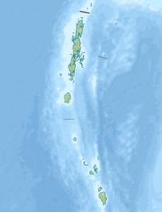
Katchal
| Katchal | ||
|---|---|---|
| Topographic map (before 2004) | ||
| Waters | Indian Ocean | |
| Archipelago | Nicobar Islands | |
| Geographical location | 7 ° 56 ' N , 93 ° 22' E | |
|
|
||
| length | 20.4 km | |
| width | 12 km | |
| surface | 174.4 km² | |
| Highest elevation | 227 m | |
| Residents | 5386 (2001) 31 inhabitants / km² |
|
| main place | Mildera | |
Katchal (Hindi: कत्चल, Nicobaric : तिहन्यु or Tihnyu , formerly Katsjul ) belongs to the Indian archipelago of the Nicobar Islands in the Bay of Bengal , in the east lies the Andaman Sea . Politically, the island belongs to the Indian Andaman and Nicobar Union territory .
With 5386 inhabitants on 174.4 square kilometers, it is only very sparsely populated. In its center, the island reaches a height of 227 meters. The largest places are Mildera, Kapanga and Jhoola.
To the east, across Revello Street , are the two neighboring islands of Camorta and Nancowry . About 70 km to the south is Klein Nikobar .
Nicobar tribes and Tamils live on Katchal and have immigrated to work on rubber tree plantations since 1964 . The island is not open to tourists; Permission to enter can be requested from the local administration in Port Blair , the capital of the Nicobar Islands.
In 1778 the island was declared an Austrian crown colony by the Trieste East India Trade Company . In 1784 this claim was given up again.
Katchal was badly hit by the tsunami following the December 26, 2004 seaquake . 1,549 inhabitants were killed, including numerous tribal leaders, many worried about the continued existence of the traditional structures. Large areas were devastated, many coconut and betel nut trees were destroyed.
Individual evidence
- ^ Page of the police with the island names ( memento of the original from March 27, 2010 in the Internet Archive ) Info: The archive link was automatically inserted and not yet checked. Please check the original and archive link according to the instructions and then remove this notice. (engl.)
- ↑ Archived copy ( Memento of the original from July 28, 2012 in the web archive archive.today ) Info: The archive link was inserted automatically and has not yet been checked. Please check the original and archive link according to the instructions and then remove this notice.
- ^ National Geospatial Intelligence Agency: PUB. 173, Sailing Directions (Enroute): India and the Bay of Bengal, Bethesda, Maryland, Ninth Edition (PDF; 4.0 MB), p. 259
- ^ Page of the police with data from 2001 ( Memento of the original from April 9, 2009 in the Internet Archive ) Info: The archive link was automatically inserted and not yet checked. Please check the original and archive link according to the instructions and then remove this notice. (engl.)
- ^ Franz Theodor Maurer, Die Nikobaren: Colonial history and description together with motivated suggestions for the colonization of these islands by Prussia , Berlin: Heymann, 1867, p. 119
- ↑ Before / after satellite image of the 2004 tsunami ( memento of the original from February 8, 2005 in the Internet Archive ) Info: The archive link was inserted automatically and has not yet been checked. Please check the original and archive link according to the instructions and then remove this notice.

