Little Nicobar
| Little Nicobar | ||
|---|---|---|
| Topographic map | ||
| Waters | Indian Ocean | |
| Archipelago | Nicobar Islands | |
| Geographical location | 7 ° 20 ′ N , 93 ° 40 ′ E | |
|
|
||
| length | 24 km | |
| width | 14 km | |
| surface | 159.02 km² | |
| Highest elevation | Mount Deoban 435 m |
|
| Residents | 432 (2001) 2.7 inhabitants / km² |
|
| main place | Pulopanja | |
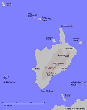
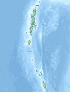
Klein Nikobar ( English Little Nicobar , Hindi: छोटा निकोबार Choṭā Nikobār, Nicobar : ओंग or Long ) belongs to the Indian archipelago of the Nicobars in the Bay of Bengal , in the east lies the Andaman Sea . Politically, the island belongs to the Indian Andaman and Nicobar Union territory .
With 432 inhabitants (as of 2001) it is only very sparsely populated on 159 square kilometers . The largest towns are Pulopanja (112 inhabitants), Pullollo / Puloulo and Makhahu / Makachua. A few kilometers south, across St.-Georg-Straße, lies the neighboring island of Groß Nikobar . In the north there are several other small islands off the coast: Menchal, Pulomilo, Treis / Albatei, Trak / Mafuya and Meroe. The neighboring island of Katchal is over 70 km to the north .
Klein Nikobar was badly hit by the tsunami following the seaquake on December 26, 2004 .
Individual evidence
- ^ Page of the police with the island names ( memento of the original from March 27, 2010 in the Internet Archive ) Info: The archive link was automatically inserted and not yet checked. Please check the original and archive link according to the instructions and then remove this notice. (engl.)
- ^ Page of the police with data from 2001 (English) ( Memento of the original from April 9, 2009 in the Internet Archive ) Info: The archive link was inserted automatically and has not yet been checked. Please check the original and archive link according to the instructions and then remove this notice.

