OpenJUMP
| OpenJUMP
|
|
|---|---|
|
|
|
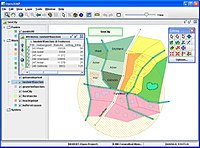
 Screenshot from OpenJUMP |
|
| Basic data
|
|
| developer | JUMP Pilot Project, Vivid Solutions, Refractions Research |
| Current version | 1.15 (02/19/2020) |
| operating system | multi-platform |
| programming language | Java |
| category | Geographic information system |
| License | GPL ( Free Software ) |
| German speaking | Yes |
| openjump.org | |
OpenJUMP is free software for geographic information systems originally developed under the name JUMP by the Canadian companies Vivid Solutions and Refractions Research . The name JUMP is the abbreviation for Unified Mapping Platform, the "J" indicates the underlying programming language Java . "Open" stands for Open Source ("open source"), and means that the source code of the program is accessible to everyone. OpenJUMP is subject to the GNU General Public License and is used today as part of the Jump Pilot Project Maintained and developed by an international group of volunteers.
Special features
The special features of OpenJUMP are:
- originally vector-based GIS with raster data support (TIFF, JPEG, PNG, ECW)
- is subject to the GNU General Public License
- is based on Open GIS standards
- written in Java; open source
- expandable by so-called plug-ins
- easy-to-use editing and analysis functions
- supports multiple languages (English, French, Portuguese, Spanish, German, Finnish, Italian)
Input & output formats
File formats:
- GML or " Geography Markup Language "
- ESRI Shapefile
- ESRI ASCII grid format with an OpenJump plugin from the SIGLE team
- TIF files
Databases (via plugin):
- PostGIS
- SpatiaLite
- SIS database
- ArcSDE
Online (via plugin):
- Web Feature Service (WFS) v. 1.0.0 and 1.1.0 client
GPS (via plugin)
- NMEA text file
- GPS receiver for the serial interface
Web links
- Official project website of OpenJUMP
- German language website of OpenJUMP
- Jump Pilot project page on Sourceforge
- JUMP on the Vivid Solutions website
- Refractions Research website
- Download page of the research focus PIROL at the FH Osnabrück
- Summary for OpenJUMP in the FreeGIS database
- Summary for JUMP Unified Mapping Platform in the FreeGIS database