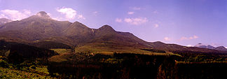
Outeniqua mountains
| Outeniqua mountains | ||
|---|---|---|
|
Outeniqua Mountains to the north of George |
||
| location | Western Cape Province ( South Africa ) | |
|
|
||
| Coordinates | 33 ° 45 ′ S , 23 ° 0 ′ E | |
The Outeniqua Mountains are a mountain range in the Garden Route District , Western Cape Province in South Africa . They belong to the cape pleated belt . The name Outeniqua means "men who carry honey" in the Khoisan language .
It extends from the breakthrough valley of the Gouritz River almost parallel to the coast north of Mossel Bay (or Mosselbaai) about 100 km to the east to Plettenberg Bay . The main road passes are the Cloetes Pass (regional road R327, from Mossel Bay to Ladismith ), the Outeniqua Pass (regional road R328), the Montagu Pass (national roads N9 and N12 ) and the Prince Alfred's Pass (regional road R339, from Knysna nor Uniondale ). Not far from the Montagu Pass, a winding railway line in the direction of Oudtshoorn overcomes the mountains.
The nature reserve Outeniqua Nature Reserve near the city of George is part of the mountain range with 38,000 hectares .
A historic steam train was named after the mountain range, the Outeniqua Choo-Tjoe , which ran between Mossel Bay, George and Knysna until 2006 . The route was discontinued after a storm and, according to the South African railway company, should not be put back into operation.
Individual evidence
- ↑ Mountain Passes of South Africa: Prince Alfred's Pass (P0059 / R339) . on www.mountainpassessouthafrica.co.za (English)
- ↑ Western Cape Nature Conservation Board (Cape Nature): Outeniqua Nature Reserve . on www.capenature.co.za (English)
- ↑ Johannes Köring et al .: Outeniqua Choo-Tjoe-Train . on www.kapstadt.de (German)

