Parc national de Bras d'Eau
Coordinates: 20 ° 9 ′ S , 57 ° 43 ′ E
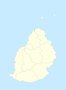
The Parc national de Bras d'Eau (French) or Bras d'Eau National Park (English) is one of the three national parks in Mauritius . Its size is about 497.2 hectares . It is located between Roches Noires in the north and Poste de Flacq in the south on the northeast coast of the island. There is also a visitor center in the national park. The Mauritius Radio Telescope is located in the park .
Flora and fauna
After the original Mauritian forests were destroyed, most of the land was used for commercial plantations of alien trees such as eucalyptus . However, two species of the Mauritian ebony tree have survived. They used to be spread all over the island.
Most of the larger animal species in Mauritius are already extinct. However, some rare bird species still live in the national park.
history
The name of the area is derived from the arm-like shape of the water, which extends from Belcourt Bay to the interior (Bras d`Eau literally means arm of water).
Because a large part of the Mauritian forests were replaced by plantations, only a small part of the original biodiversity survived . This prompted the establishment of the national park.
The park was established on October 25, 2011 and, like the other national parks on the island (except Islets National Park ), is managed by the Mauritian National Parks and Conservation Service. Unlike the well-known Black River Gorges National Park , this national park is even quieter and less touristy.
Tourists
The national park is located on the coast in the northeast of the island near the municipality of Poste Lafayette . A large area of water called Mare Sarcelle covers a large part of the national park with 89 hectares. The area is home to mangrove swamps and a wide variety of birds. This place is very popular with bird watchers.
In the national park there are also remains of over 200-year-old ruins of a former sugar factory and a lime kiln. Marked hiking trails start at the visitor center and picnic tables are available.
Web links
Individual evidence
- ↑ BRAS-D'EAU: Balade au cœur du dernier carré de forêt côtière sèche ( Memento of the original from February 15, 2015 in the Internet Archive ) Info: The archive link was inserted automatically and has not yet been checked. Please check the original and archive link according to the instructions and then remove this notice. , Le Mauricien, July 14, 2012

