Peucang
| Peucang | ||
|---|---|---|
| Peucang Beach | ||
| Waters | Teluk Peucan , Sunda Strait , Indian Ocean | |
| Archipelago | Great Sunda Islands | |
| Geographical location | 6 ° 44 '18 " S , 105 ° 15' 25" E | |
|
|
||
| length | 3 km | |
| width | 2 km | |
| surface | 4.7 km² | |
| Highest elevation | 4 m | |
| Residents | uninhabited | |
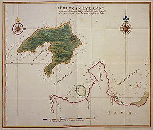
| Map by Johannes Vingboons (approx. 1665–1668): Nieuwe Eylandt | ||
Peucang , formerly also Peutjang , during the Dutch colonial era Nieuw Eiland ( New Island ), is a small, flat and uninhabited island in Teluk Peucang Bay, which is adjacent to the Sunda Strait . It belongs to the Ujung Kulon National Park in the Indonesian government district of Pandeglang .
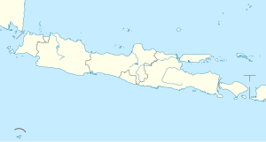
Peucang is located 570 meters west of the coast of Java , at the headland of Tanjung Jungkulan , separated by the Ci Cukanggalih Strait . 8.7 km northwest of the island is the southern tip of Tanjung Karangjajar on the larger island of Panaitan , from which it is separated by the Selat Panaitan Strait .
Peucang is a densely forested island. It is three kilometers long from north to south and up to two kilometers wide, with an area of 4.7 km².
Deer , wild boar and monkeys live on the island .
Individual evidence
- ↑ measured with ArcGis Here Satellite Image Tiles


