
Piñera (Uruguay)
| Piñera | ||
|---|---|---|
|
Coordinates: 32 ° 20 ′ S , 57 ° 3 ′ W Piñera on the map of Uruguay
|
||
| Basic data | ||
| Country | Uruguay | |
| Department | Paysandú | |
| Residents | 118 (2004) | |
| Detailed data | ||
 |
||

Piñera is a town in Uruguay .
geography
It is located in the Paysandú department in sector 5 . Piñera is located about 20 kilometers east-northeast of Guichón and northwest of Merinos . Beisso borders in the north . The border with the neighboring Río Negro district runs about two kilometers south of the village .
history
On August 21, 1936, Piñera was granted the status of "pueblo" by Law 9,588.
Residents
In the 2004 census, the population of Piñera was 118.
| year | Residents |
|---|---|
| 1963 | 313 |
| 1975 | 261 |
| 1985 | 189 |
| 1996 | 193 |
| 2004 | 118 |
Source: Instituto Nacional de Estadística de Uruguay

Escuela Nº 17 "José María Firpo"

Almacén de Ramos Generales
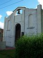
Capilla María Auxiliadora
.jpg)


Web links
- City map of Piñera (PDF; 85 kB)