Pikkjärv
| Pikkjärv | ||
|---|---|---|

|
||
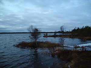
| The Pikkjärv in winter | ||
| Geographical location | Saaremaa Island , Estonia | |
| Drain | Maadevahe | |
| Data | ||
| Coordinates | 58 ° 28 '31 " N , 22 ° 57' 57" E | |
|
|
||
| Altitude above sea level | 9.7 m | |
| surface | 22.5 ha | |
| length | 850 m | |
| width | 350 m | |
| scope | 2.43 km | |
| Maximum depth | 3 m | |
| Middle deep | 1.5 m | |
The Pikkjärv is a lake on the Estonian island of Saaremaa . Other names of the lake are Pitkjärv , Koigi Pitkjärv and Koigi Pikkjärv .
The Pikkjärv is located in the moor of Koigi ( Estonian Koigi Raba ). Administratively it belongs to the Saaremaa municipality . The Pikkjärv is 9.7 m above sea level. The circumference of the lake is 2.43 km, its area 22.5 ha. The greatest depth is 3 m, the average depth is 1.5 m.
The water is brown-orange. The most important fish species are pike and roach .
The only outflow from the lake is the Maadevahe stream.
Web links
- Full description (Estonian)
