Prevost Island
| Prevost Island | ||
|---|---|---|
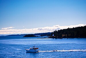
| Boat off Prevost Island and smaller offshore islands | ||
| Waters | Strait of Georgia | |
| Geographical location | 48 ° 50 ′ 0 ″ N , 123 ° 23 ′ 0 ″ W | |
|
|
||
| surface | 6.85 km² | |
Prevost Island is a 685 hectare island off the southeast coast of Vancouver Island on the Canadian Pacific coast. It belongs to the Gulf Islands in the Georgia Strait ; the Prevostinsel is near Ganges Harbor and halfway between the southeast end of Saltspring Island in the west and the south end of Galiano Island in the east. The island was named after James Charles Prevost , who was British Commissioner from 1850 to 1854 and from 1857 to 1860 and during whose service there were border disputes between Canada and the USA, the " Pig War ".
history
At the beginning of the 1980s , a shell midden was found on the island, consisting mainly of marine animals , a waste mound that documents a very early use of the island. These kitchen rubbish heaps, named after the Danish term køkkenmøddinger , are relatively common in the Gulf Islands region - around thirty are known - but the hill on Prevost Island is the only one within the Gulf Islands National Park Reserve and it is also off the coast Coast. Therefore it could be a ritual place or a trading place. The Tsawout First Nation believes that their ancestors left these historically significant traces that are now about to be excavated. Therefore, in 2013, in addition to twelve students from the University of Victoria, two representatives of the tribe also took part in the campaign.
The Irishman Digby de Burgh bought the island in the 1920s and grazed sheep, goats and cattle there. Other buildings besides those of this family were built in the northwest of the island. Around 80 hectares of the island area were used for agriculture at the end of the 1980s.
In 1895 a lighthouse, the Portlock Point Lighthouse , was built on the east end of the island , instead of a beacon built in 1890.
Flora and fauna
The deciduous trees on the island include red or oregon alder ( Alnus rubra ), large-leaved maple ( Acer macrophyllum ), western balsam poplar ( Populus balsamifera ssp.trichocarpa ), then Nuttall's flower dogwood ( Cornus nuttallii ) and those belonging to the genus Prunus counting Prunus emarginata , here called bitter cherry .
literature
- Daryl W. Fedje, Ian D. Sumpter, John R. Southon: Sea-levels and Archeology in the Gulf Islands National Park Reserve , in: Canadian Journal of Archeology / Journal Canadien d'Archéologie 33 (2009) pp. 234-253.
Web links
- Prevost Island . In: BC Geographical Names (English)
Remarks
- ^ Andrew Scott: The Encyclopedia Of Raincoast Places Names: A Complete Reference to Coastal British Columbia . Habour Publishing, Madeira Park (BC) 2009, ISBN 978-1-55017-484-7 , pp. 476 (English).
- ^ Rare midden near Saltspring Island a gem for research , in: Times-Colonist, June 24, 2013.
- ^ EA Kenney, LJP van Vliet, AJ Green: Soils of the Gulf Islands of British Columbia , Vol. 2, Victoria 1988, p. 7.


