Promontory Fort from Chester Hill
Coordinates: 55 ° 50 ′ 5.8 " N , 2 ° 4 ′ 38.8" W.
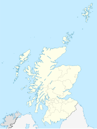
The Promontory Fort from Chester Hill (actually "Ancient Promontory Fort" on Chester Hill; also called Greystonelees) is located south of Burnmouth , near the border with England at Berwick-upon-Tweed , in the Scottish Borders in Scotland . The Promontory Fort from the Iron Age overlooks the coast north of Berwick-upon-Tweed.
It consists of two enclosures (probably two construction phases). The western one, with its clearly defined rampart and moat, is in better condition. The eastern (probably older) is only marked by a low, widened earth wall.
The twin enclosures are similar to those of the Iron Age Fort Earn's Heugh, about 11.0 km away .
literature
- Anna Ritchie, Graham Ritchie: Scotland. Archeology and Early History. Thames and Hudson Ltd., London 1981, ISBN 0-500-02100-7 ( Ancient places and people ).

