Ralph Stover State Park
|
Ralph Stover State Park
|
||
|
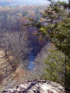
View from High Rocks on Tohickon Creek |
||
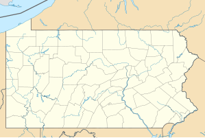
| location | Bucks County in Pennsylvania (USA) | |
| surface | 18 ha | |
| Geographical location | 40 ° 26 ' N , 75 ° 6' W | |
|
|
||
| Setup date | 1931 | |
| administration | Pennsylvania Dept. of Conservation and Natural Resources | |
Ralph Stover State Park is a park in Pennsylvania , in Bucks County . It stretches along Tohickon Creek , is 18 acres, and is located approximately 3.5 kilometers from the village of Point Pleasant, Pa. A main attraction of the park is a rock formation, which is known as "High Rocks".
history
Lenni Lenape Indians first settled in this area. They gave the river (Creek) the name "To-Hick-Hanne" which was later changed to Tohickon Creek. The Stoven family of German origin (German Stauffer) later acquired this area. Ralph Stover - son of Henry Stauffer and Barbara Hockman - built a mill on Tohickon Creek.
In 1931, during the Great Depression, Ralph Stoven gave the land to the Commonwealth of Pennsylvania. The state converted the area into a park and hired unemployed people. This was a request from Ralph Stoven. The park opened in 1935.
Specialty
A visitor magnet of the park is "High Rocks". High Rocks is around 60 meters high and offers the opportunity for rock climbing. From the plateau of the rock you have a great view of Tohickon Creek.
In addition to climbing, you can also go hiking, fishing or kayaking in the park.
Web links
Individual evidence
- ^ State Park Office: Ralph Stover State Park. (PDF) Retrieved July 1, 2017 .
- ^ State Park Office: High Rocks. Retrieved July 1, 2017 .

