Rough castle east of Ebermergen
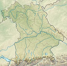
The natural monument Rauhe Burg east of Ebermergen , also known as Rauhe Birk , is located directly on the B25 between Donauwörth and Nördlingen behind a parking lot at the level of the Harburg district of Ebermergen .
Coordinates: 48 ° 45 ′ 11.8 " N , 10 ° 43 ′ 28.8" E
The striking geological outcrop was cleared in 2015 as part of a maintenance measure. The recognizable former quarry was ejected during the Ries impact and strongly transformed into breccia ; the original rock was a striking Malm clod . Gravelings can be seen around the summit at several former mining sites. The dimensions are approx. 120 m long, 30 m wide and 25 m high. At the same time, the Rauhe Burg is an object on the Bavarian List of Monuments, No. D-7-7230 0104, and is registered as a land and natural monument. There was a Neolithic settlement here, as well as a castle stables and body graves from the Middle Ages . A walled stone tablet shows that the castle was in ruins as early as 1366.
The area can be accessed with appropriate caution both on the quarry floor and on the hilltop, but there are no climbing aids or fall protection.
The rock face has been designated as a valuable geotope by the Bavarian State Office for the Environment (Geotope number: 779A001).
See also
- List of geotopes in the Donau-Ries district
- List of architectural monuments in Harburg (Swabia)
- List of natural monuments in the Donau-Ries district
Individual evidence
- ↑ Bavarian State Office for the Environment, Malmscholle Rauhe Birk E von Ebermergen (accessed on October 7, 2017).

