Saint-Ferréol reservoir
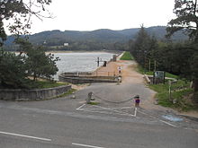
The reservoir of Saint-Ferréol (French: Bassin de St. Ferréol or Barrage de Saint-Ferréol) is a dam and was built in the 17th century to supply water to the Canal du Midi near Naurouze and Revel on behalf of Louis XIV . The dam is about 20 kilometers away from the apex of the canal that connects the Mediterranean and the Atlantic. The architect and planner of the system and the entire canal was Pierre-Paul Riquet . Louis Nicolas de Clerville was also involved as an engineer.
The barrier structure consists of a wall made of masonry, which was used for sealing, with embankments on both sides, which ensured stability. The waterside dam is a little lower. The dam was initially 30 m high and was increased to 36 m in 1685. It is 780 to 800 m long and 120 m wide at its base. Between 1667 and 1672 up to 1000 workers worked on it. The dam dams the Laudot River , which brings the water from the Montagne Noire , about 30 km away .
A water pipe (Rigole de la Plaine) was built from the dam to the village of Naurouze, where a few years later the canal's apex was placed.
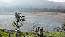
The reservoir stores up to 6.3 million cubic meters of water and is 64 to 67 hectares in size. The water level is 350 m above sea level. At the time, it was the largest man-made active dam in the world. The dam was also the highest earth dam in the world for about 200 years . Today it is a UNESCO World Heritage Site with the Canal du Midi .
Below the dam there is a fountain in the Jardins du Canal du Midi that is fed from the lake. It is 30 m high. The Musée du Canal du Midi is located right next to the wall in the former house of engineers .
Web links
Individual evidence
literature
- Adeline Béa, Jérôme Bonhôte, Émilie Collet and others: Aux sources du canal du Midi - Son système d'alimentation. published by the Conseil Régional Midi-Pyrénées in the series Patrimoines Midi-Pyrénées. 2nd Edition. Toulouse 2013, ISBN 978-2-9535212-3-8 .
Coordinates: 43 ° 26 ′ 15 ″ N , 2 ° 1 ′ 18 ″ E

