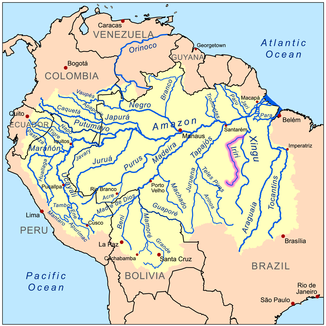
Rio Iriri
| Rio Iriri | ||
|
Location of the Rio Iriri in South America |
||
| Data | ||
| location | Brazil | |
| River system | Amazon | |
| Drain over | Rio Xingu → Amazon → Atlantic | |
| muzzle | South of Altamira Coordinates: 3 ° 49 ′ 0 ″ S , 52 ° 36 ′ 20 ″ W 3 ° 49 ′ 0 ″ S , 52 ° 36 ′ 20 ″ W
|
|
| length | about 1300 km | |
| Left tributaries | Rio Curuá | |
The Rio Iriri is a left tributary of the Rio Xingu in Brazil and about 1,300 km long.
The river has its source in the Serra do Cachimbo mountain range in the north of Mato Grosso near Guarantã do Norte . After that it first flows north. After it has united with its main tributary, the Rio Curuá , its course changes to the east. It flows into the Rio Xingu south of Altamira . The area around the Rio Iriri is sparsely populated. Along the river there are sometimes large clearings that were created by the deforestation of the rainforest.
