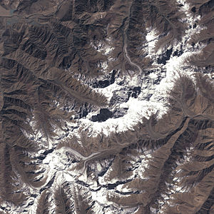
Rupal glacier
| Rupal glacier | ||
|---|---|---|
| location | Gilgit-Baltistan ( Pakistan ) | |
| Mountains | Western Himalayas | |
| Type | Valley glacier | |
| length | 14 km | |
| Exposure | East northeast | |
| Altitude range | 5900 m - 3650 m | |
| width | ⌀ 1.3 km | |
| Coordinates | 35 ° 10 ′ N , 74 ° 32 ′ E | |
|
|
||
| drainage | Rupal → Tarishing → Ratu → Astor | |
|
Rupal Glacier and the Toshaing Glacier, which flows into it from the left, in the picture below on the left |
||
The Rupal Glacier is located in the Astore district in the Pakistani special territory of Gilgit-Baltistan .
The 14 km long glacier flows through the Nanga Parbat massif in the western Himalayas in an arc initially in a north-westerly direction, later in a north-westerly and finally in an east-northeastern direction . The Toshaingletscher flows into the glacier on the left. The southern Shaigiri glacier meets the Rupal glacier when coming from the south. The glacier ends on the southern flank of Nanga Parbat, the so-called “Rupal flank”. The Rupal Glacier is framed by the following mountains: Toshain V ( 6110 m ), Schlagintweit Peak ( 5971 m ) and Turpin Peak ( 5901 m ).
The Rupal Glacier feeds the Rupal and is named after this glacier stream . The Rupal flows through the Rupal Valley (Rupaltal) and flows into the Astor . In the Rupaltal there is also a small settlement called Rupal .
Web links
- Map at himalaya-info.org - shows the Rupal Glacier , the Rupal glacier stream ( Rupal Gah ) and the village of Rupal

