Saeki-ku (Hiroshima)
Saeki ( Japanese 佐伯 区 , - ku ) is the youngest of the eight districts (-ku) of the independent city (-shi) Hiroshima , the capital of the prefecture (-ken) Hiroshima . It was created in 1985 when the city (-chō) Itsukaichi from the neighboring district (-gun) Saeki was incorporated into the city of Hiroshima. Itsukaichi was previously the largest city in Japan with a population of over 87,000, and with the incorporation, Hiroshima became a city of millions. In 2005, the district was enlarged by incorporating the neighboring small town of Yuki from Saeki County to the northwest . In the same year, the other two remaining cities in Saeki County were incorporated into Hatsukaichi and Saeki County became extinct. The Saeki district has 138,346 inhabitants (as of June 1, 2019) and an area of 225.43 km² (as of October 1, 2017).
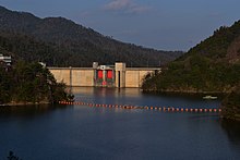
Saeki-ku is located west of the city center of Hiroshima, off the right of the river valley of the Ōta-gawa , with the incorporation of Yuki, the district in the north-west includes the valley of the Minochi ( 水 内 川 , -gawa ) to the confluence with the Ōtagawa and extends thus in the north to the Ōta valley. In the southeast of the district in Itsukaichi, the short, approximately 20 km long Yahata-gawa flows into the sea, which is independent of the Ōta river system. Its source lies below the over 800 m high Amida-yama and the over 900 m high Tōgō-zan. Other higher mountains in the district are in the west on both sides of the upper reaches of the Minochi the thousand- meter peaks Ōmine ( 大 峯山 , -zan / -yama ) and [Yuki-] Kanmuri ( [湯 来] 冠 山 , -yama ; in the Asakita district there are two other mountains Kanmuri , the Kuchi-Kanmuri and on the border of the district the Kabe-Kanmuri) and the over 900 m high Tenjō ( 天上 山 , -zan ) on the northern border. In the west, the Saeki district is now bordered by the independent city of Hatsukaichi , in the north by the city of Aki-Ōta in Yamagata County , in the east by Hiroshima's districts Asa-Kita, Asa-Minami and Nishi.
In the north-west of Itsukaichi is the Botanical Garden of the City of Hiroshima (Hiroshima-shi shokubutsu-kōen) - the park is urban, but was established outside the city of Hiroshima in 1976 with the approval of the City Parliament of Itsukaichi.
Web links
- Hiroshima City Council: Saeki District Office (Saeki-kuyakusho) (Japanese, machine translations English, Chinese, Korean)
Individual evidence
- ↑ 広 島 県 の 人口 移動 (広 島 県 人口 移動 統計 調査) 最新 | 広 島 県 . 広 島 県 , June 1, 2019, accessed July 5, 2019 (Japanese).
- ↑ Kokudo Chiriin : 平 成 29 年 全国 都 道 府 県 市区 町 村 別 面積 調 , 34 広 島 県
- ^ Website of the Botanical Garden (Japanese, brochure and basic information also in English and in other languages), history
Coordinates: 34 ° 22 ' N , 132 ° 22' E


