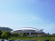
Asaminami-ku (Hiroshima)

Asaminami-ku ( Japanese 安佐南 区 , "Asa-South District") is one of the eight districts (- ku ) of the urban district (- shi ) Hiroshima , the capital of Hiroshima Prefecture in western Japan. It is located north of the city center of Hiroshima and has an area of 117.24 km², making it the third largest district of Hiroshima after Asakita and Saeki. With 245,980 inhabitants (as of June 1, 2019) it is the most populous of the eight districts.
geography
In the east, the district is bounded by the Ōta-gawa , another densely populated area is the curved valley through which the Yasukawa flows around the 400-meter-high Takeda-yama, on which a Takeda castle once stood. In the west, further small valleys and higher mountains belong to the district, on the border to Saeki-ku are the over 700 m high Madogayama and the over 900 m high Tōgōzan.
history
The Asaminami district was established in 1980 when the city of Hiroshima was named a city by government decree ( seirei shitei toshi ) and comprises parts of the Asa district (- gun ) of Hiroshima Prefecture, which was completely incorporated into the city of Hiroshima in the 1970s , namely the former cities ( -chō) Gion (in the southeast), Yasufuruichi (north of it), Satō (in the northeast) and Numata (off the river in the west). Asa-Minami borders the following districts of the city of Hiroshima: in the north and east on Asa-Kita ("Asa-North"), in the southeast on the inner districts of Higashi ("East") and Nishi ("West") and since 1985 in Southwest, since 2005 also in the west at Saeki , the youngest district of the city - before that was the city boundary from Hiroshima to Itsukaichi and Yuki in Saeki district .
traffic
The San'yō highway runs through the district, which bypasses the old city center of Hiroshima extensively, in the west in Ōzuka it meets the Hiroshima highway . From there, the Hiroshima No. 4 city motorway also leads into the city through the almost four-kilometer-long Seifū tunnel. In the East the lead cable struc- ture Kaidō in this area (National Road 183) and the Gion Shindo (National Road 54) via the Ōta-gawa in the city center. The Kabe line of the JR Nishi-Nihon runs parallel to the Kabe-kaidō through the Ōta valley. The Astram runs over the Gion-shindō and then through the Yasu Valley to Hiroshima kōiki-kōen .
Web links
- Hiroshima City Council: Asaminami District Administration (Japanese)
Individual evidence
- ↑ Hiroshima City Administration, Asa minami District Administration: 区 の 概要 , accessed August 7, 2018
- ↑ 広 島 県 の 人口 移動 (広 島 県 人口 移動 統計 調査) 最新 | 広 島 県 . 広 島 県 , June 1, 2019, accessed July 5, 2019 (Japanese).
Coordinates: 34 ° 27 ' N , 132 ° 28' E

