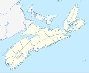
Saint Paul Island (Nova Scotia)
| Saint Paul Island | ||
|---|---|---|
| Lighthouse on the island | ||
| Waters | Cabot Strait (Atlantic Ocean) | |
| Geographical location | 47 ° 12 '10 " N , 60 ° 9' 3" W | |
|
|
||
| length | 4.8 km | |
| width | 1.7 km | |
| surface | 5 km² | |
| Highest elevation |
Croggan Mountain 147 m |
|
| Residents | uninhabited | |
Saint Paul Island ( French Île Saint-Paul , German also Sankt-Paul-Insel ) is a small and uninhabited Canadian island, which is about 24 kilometers northeast of Cape North (on the Cape Breton Island ) and 71 kilometers southwest of Cape Ray (on the island of Newfoundland ) is located. This is roughly the area where the Gulf of St. Lawrence borders the Cabot Street. Administratively, St. Paul Island belongs to the Canadian province of Nova Scotia and also forms the northernmost territory of this province.
geology
The island lies on the continuation of the Appalachian Mountains and the Cape Breton highlands . The highest point on Saint Paul Island is the summit of Croggan Mountain at 147 meters . St. Paul Island is made of granite and its rugged coastline is lined with rocky cliffs. A narrow channel filled with sea water separates the northernmost part of the island from the main island.
fauna
There are no larger land animals on the island, but it is populated by numerous sea birds. Their ecosystem is considered to be very sensitive and because of the dangers associated with visiting the island, each step on the island must be coordinated in advance with the Canadian coast guard, who owns the island.
history
The island is also known as the Gulf Cemetery (meaning the Gulf of St. Lawrence) because it is mostly foggy during the navigable season and therefore posed a significant danger during the sailing age. It is very likely that the island was already visited by the Mi'kmaq Indians, but apart from oral tradition there is no verifiable evidence of this. As far as is known, the island was first discovered in 1497 by the Italian John Cabot , who was in English service .
present
Since the island's beacon was automated with the help of solar energy, it has been visited relatively rarely. Only the Canadian Coast Guard's helicopters still land on it regularly for maintenance purposes. There used to be a Marconi radio station on the island and radio amateurs still occasionally report with the callsign prefix CY9, which is valid for the St. Paul island. Other visitors to the island are bird watchers and scuba divers.
Web links
- The cemetery of the Gulf (Engl.)


