Santa Catalina Mountains
| Santa Catalina Mountains | ||
|---|---|---|
| Highest peak | Mount Lemmon ( 2791 m ) | |
| location | Arizona (USA) | |
|
|
||
| Coordinates | 32 ° 27 ′ N , 110 ° 47 ′ W | |
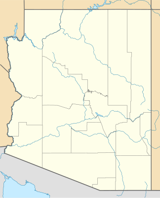
Santa Catalina Mountains is a mountain range north of Tucson , Arizona . The mountain range, which is often just called the Catalinas , is part of the Sky Islands . The highest point of the Catalinas is Mount Lemmon ( 32 ° 27 ' N , 110 ° 47' W ) with a height of 2791 meters. Summerhaven at the foot of Mount Lemmon is a resort in the hot desert state of Arizona. At the same time, Mount Lemmon is the southernmost ski area in the United States. The Santa Catalina Mountains are part of the Coronado National Forest and contain the Pusch Ridge Wilderness Area. The area offers numerous destinations for tourists such as Sabino Canyon and Catalina State Park with extensive hiking opportunities.
Places in the mountains
- Sabino Canyon
- Mount Lemmon
- Catalina State Park
- Pusch Ridge Wilderness Area
- Catalina Highway
- Summerhaven
mountains
Canyons
Web links
Commons : Santa Catalina Mountains - Collection of images, videos and audio files
- The Santa Catalina Mountains. In: The Saguaro Juniper Corporation (English)
- Santa Catalina Mountains. In: Arizona Handbook (English)

