Schiessrothried lake
| Schiessrothried lake | ||
|---|---|---|

|
||
| Schiessrothried lake | ||
| Geographical location | Vosges , France | |
| Drain | Wormsabachrunz → Fecht → Ill → Rhine → North Sea | |
| Data | ||
| Coordinates | 48 ° 1 '47 " N , 7 ° 1' 31" E | |
|
|
||
| Altitude above sea level | 926 | |
| surface | 0.056 | |
| length | 0.4 | |
| width | 0.25 | |
| volume | 326000 | |
| Maximum depth | 11 m | |
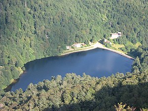
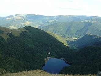
The Schiessrothried lake is a small reservoir in the Vosges . It was created as a glacier lake at the end of the Ice Age , but later silted up to form a raised bog. In order to regulate the water supply for mills in the Münstertal , a dam was built between 1887 and 1891, which created today's lake on the moor. This has a length of about 400 m with a maximum width of 250 m and a depth of 11 m. Its outflow, the Wormsabachrunz, flows a few kilometers into the Fecht , which flows through the Münstertal.
Web links
Commons : Schiessrothried - collection of images, videos and audio files

