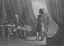
Battle of Horseshoe Bend
| date | March 27, 1814 |
|---|---|
| place | Wetumpka , Alabama , USA |
| output | Decisive victory for the United States |
| Parties to the conflict | |
|---|---|
|
Red Stick Creek |
|
| Commander | |
| Troop strength | |
| 1,000 Red Stick Creek | about 2,000 infantrymen 700 mounted infantrymen 600 Cherokee and Creek |
| losses | |
|
800 |
49 dead |
The Battle of Horseshoe Bend was a skirmish between the U.S. Army and its Native American allies on one side and Warriors of the Creek and Red Sticks on the other in 1814.
background
The Battle of Horseshoe Bend has nothing to do with British or Canadians, but is still considered part of the British-American War of 1812 . It was actually the decisive battle in the so-called Creek War, in which Andrew Jackson wanted to "clear" Alabama for settlement by American settlers. General Jackson was in command of the West Tennessee militia, from which he had formed a powerful force. The militia was supported by the 39th US Infantry and about 600 Cherokee and Lower Creek Indians. Opposite them stood the tribe of Red Stick Creek. In the spring of 1814, Jackson's troops left Fort Williams and crossed the woods towards the Red Stick Creek camp under their chief Menawa .
Ten kilometers from his destination, Jackson camped at Tallapoosa , an area called Horseshoe Bend in Alabama. He ordered General John R. Coffee with the mounted infantry and the allied Indians to cross the river to the south in order to surround the Red Stick camp. Jackson meanwhile stayed north of the camp with 2,000 infantrymen.
![]()
The battle
At around 10:30 a.m. on March 27, Jackson began bombarding the camp with two cannons for about two hours. However, almost none of the red sticks was hit and the fastenings remained intact. At the same time General Coffee crossed the river with his horsemen and the Cherokee and attacked the Red Sticks in their backs. Jackson then ordered a bayonet attack . The infantry overcame the parapets that surrounded the camp and the Red Sticks caught in the crossfire of both troops. Sam Houston (future governor of Tennessee and Texas) served as a lieutenant in Jackson's army. Houston was one of the first to break the barricades alive. He was only injured by an arrow from the creek. However, this injury would hinder him for the rest of his life.
The battle raged for five hours. About 550 Red Sticks were killed in the camp and many others while trying to flee across the river. The later United States Senator , John Eaton wrote: "This battle made the hopes (of the enemy) destroyed to make further resistance .... In this fight their best and bravest warriors were killed. "
Chief Menawa had been badly wounded and was only able to get to safety with 200 of the original 1,000 warriors. They moved to the Seminole area in Spanish Florida . So that the militia could determine the exact number of victims, the tips of the noses of the killed opposing creek were cut off. There were also further attacks, in which some of the victims' skin was peeled off in order to make articles of daily use.
Review
On August 9, 1814, Andrew Jackson forced the Creek to sign the Fort James Jackson Peace Treaty . Despite vigorous protests by the Creek Indians, who fought alongside Jackson, they were forced to cede 93,000 km² (half of Alabama and part of southern Georgia) to the United States government. In addition, the Cherokee, who were allied with the United States, claimed 7,700 km² of the land.
The Creek War was actually a tribal war between rival groups and not part of the War of 1812. This battle, as well as the Battle of New Orleans, made Andrew Jackson so popular that he won the election of President of the United States in 1828 .
The battlefield can still be viewed today at Horseshoe National Military Park .
literature
- Steve Rajtar, "Indian War Sites" (McFarland and Company, Inc., 1999)
- John Ehle , Trail of Tears The Rise and Fall of the Cherokee Nation (Anchor Books Editions 1989), pg 117-121 ISBN 0-385-23954-8
- Andrew Burstein The Passions of Andrew Jackson (Alfred A. Knopf 2003), p. 105-106 ISBN 0-375-71404-9
- Aram Mattioli : "We shot them like dogs." In: DIE ZEIT of December 25, 2014 (Repressed crimes: The British-American War sealed the fate of the Indian nations between 1812 and 1814.)
Web links
Individual evidence
- ↑ Don C. East: A Historical Analysis of the Creek Indian Hillabee Towns Iuniverse books, Bloomington 2008, page 71 ISBN 978-1-4401-0154-0
Coordinates: 32 ° 58 ′ 21.1 " N , 85 ° 44 ′ 11.6" W.


