Saddle of pork (Schleswig-Holstein)

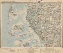
Topographical overview map of the German Empire, sheet 08/09 Westerland-Tondern (1906): The map shows the pork back west-southwest of Langeness ( north marsh ).
The pork back is a mudflat between the Hallig Langeneß and the island of Amrum . It is surrounded by the north marshland fairway in the east, the mudflat Marschnack in the north, the Norderaue in the northwest and the fairway Schweinsücken-Durchfahrt in the south. The Süderaue runs further south .
The area used to belong to the Wiedrichsharde .
The area usually dries out at low tide and is then populated by seals in summer . Together with the Marschnack, the pig's back protects Langeneß from flooding .
Individual evidence
- ↑ Christian Peter Hansen: The Schleswig Wadden Sea and the Frisian Islands . 1865, p. 32 . ( online )
- ↑ Jörg Niendorf: Low flight over the pig's back. In: Berliner Zeitung . June 30, 2004, accessed June 11, 2015 .
- ↑ Achim Taubert: Morphodynamics and morphogenesis of the North Frisian Wadden Sea . Hamburg 1986, ISBN 978-3-506-73642-0 , pp. 175 .
Coordinates: 54 ° 37 ′ 45.8 " N , 8 ° 28 ′ 40.8" E